This is an old revision of this page, as edited by Yobot (talk | contribs) at 06:04, 26 September 2013 (WP:CHECKWIKI error fixes using AWB (9494)). The present address (URL) is a permanent link to this revision, which may differ significantly from the current revision.
Revision as of 06:04, 26 September 2013 by Yobot (talk | contribs) (WP:CHECKWIKI error fixes using AWB (9494))(diff) ← Previous revision | Latest revision (diff) | Newer revision → (diff)
 MV Rabaul Queen arriving at Kimbe Port in 2009 MV Rabaul Queen arriving at Kimbe Port in 2009
| |
| History | |
|---|---|
| Name | MV Rabaul Queen |
| Owner | Rabaul Shipping |
| Operator | Star Ships |
| Port of registry | |
| Route | Kimbe—Lae |
| Completed | 1983 (1983) |
| Out of service | 2 February 2012 |
| Identification | list error: <br /> list (help) IMO number: 8351297 Call sign: P2V4040 |
| Fate | Sunk |
| General characteristics | |
| Class and type | passenger ferry |
| Tonnage | 259 GT |
| Length | 155 ft (47 m) |
| Capacity | 310 passengers (permitted) |
| Crew | 12 |

MV Rabaul Queen was a passenger ferry owned by the Papua New Guinea company Rabaul Shipping. The ship, built in Japan in 1983, operated on short runs in that country, before being brought to Papua New Guinea in 1998 and plying a regular weekly route between Kimbe, the capital of West New Britain, and Lae, the capital of the mainland province of Morobe. In the early hours of 2 February 2012, the ferry capsized and later sank in rough conditions.
Capsize and sinking
Incident
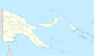
Early in the morning of 2 February 2012, the ship capsized due to rough conditions in the Solomon Sea. The ship was hit by three large waves. About four hours later, at approximately 6:00 am local time (8:00 pm on 1 February UTC), she sank 9 nautical miles (16 km) from Finschhafen. She was near the end of her 20-hour journey from Kimbe to Lae. 12 crew and an estimated 350 passengers were aboard at the time, though it is possible there may have been more than 500 passengers on the ferry.
Rescue and recovery
A joint rescue effort by Papua New Guinea and Australia was formed shortly after the sinking. 246 survivors were rescued by nightfall on 2 February. As of 5 February 2012, the bodies of six victims have been recovered, and no further survivors have been rescued. Over 100 are still missing. Seven of the survivors were admitted to Angau Memorial Hospital in Lae, three of whom had serious injuries. It was reported that 27 survivors were on an uninhabited island; one survivor contacted a family member with a cell phone, although Papua New Guinea's Maritime Safety Authority claimed on 5 February that any survivors would already have been located.
Many survivors were rescued by six merchant vessels alerted by the Australian Maritime Safety Authority (AMSA), which was alerted by Rabaul Shipping that the ferry had disappeared from a satellite tracking system. Seven fixed wing aircraft, including a P-3 Orion maritime patrol aircraft from the Royal Australian Air Force, three helicopters and seven boats were involved in locating survivors. On 11 February it was reported that some of the survivors were having stomach pains because they swallowed seawater containing oil leaking from the boat.
Revised casualty figures
On 10 February 2012, Radio New Zealand reported that the number of people rescued had been re-calculated as 237, and that the number of people missing (based on new information from relatives of those onboard) was 321. This would indicate that some 558 people were aboard the vessel. It was only permitted to carry 310.
Investigation
A Commission of Inquiry had been set up and led by Warwick Andrew, who submitted the final report to caretaker Prime Minister Peter O'Neill. O'Neill said that the 200-page report would first need to be tabled in parliament before its release and would thus have to wait for the new parliament to sit following the general election.
References
- World Shipping Register accessed 2 February 2012
- ^ "Passenger Ferry MV RABAUL QUEEN Sinks – Updated", Maritime Matters, 1 February 2012, retrieved 3 February 2012
- ^ "More than 250 rescued after Papua New Guinea ferry sinks", CTV.ca, 2 February 2012, retrieved 3 February 2012
- "100 feared dead as storm swamps ferry", Vancouver Sun, Canada, 3 February 2012, retrieved 4 February 2012
- "More than 100 missing, feared dead after ferry sinks off Papua New Guinea coast", National Post, Canada, 1 February 2012, retrieved 4 February 2012
- "PNG ferry survivors battled to stay alive", The Sydney Morning Herald, Fairfax Media, 3 February 2012, retrieved 3 February 2012
- "PNG ferry search continues", Australia Network News, 3 February 2012, retrieved 3 February 2012
- ^ "The official death toll in the sinking of a ferry off Papua New Guinea has risen to six.", Radio New Zealand, 5 February 2012, retrieved 5 February 2012
- "Authorities recover four bodies from MV Rabaul Queen ferry disaster", Herald Sun, Australia, 4 February 2012, retrieved 4 February 2012
- "Winds hamper PNG ferry victims search", news.com.au, 5 February 2012, retrieved 5 February 2012
- "Papua New Guinea ferry: Fears grow for 100 missing". BBC News. 3 February 2012. Retrieved 3 February 2012.
- "Defence Ministers » Parliamentary Secretary for Defence – RAAF AP-3C Orion returns from PNG search and rescue mission". Retrieved 5 February 2012.
- "Death toll rises in ferry disaster", telegraph.com.au, 5 February 2012, retrieved 6 February 2012
- http://www.radionz.co.nz/news/world/98167/ferry-survivors-suffer-stomach-pain-after-swallowing-oil
- "300 now feared dead in PNG ferry sinking", Radio New Zealand News, 10 February 2012, retrieved 10 February 2012
- http://www.abc.net.au/news/2012-06-29/an-png-ferry-sinking-report/4100556
6°31′05″S 147°59′07″E / 6.51806°S 147.98528°E / -6.51806; 147.98528
Categories: