This is an old revision of this page, as edited by Abhiguru Pandey (talk | contribs) at 10:19, 2 March 2015 (→Gallery). The present address (URL) is a permanent link to this revision, which may differ significantly from the current revision.
Revision as of 10:19, 2 March 2015 by Abhiguru Pandey (talk | contribs) (→Gallery)(diff) ← Previous revision | Latest revision (diff) | Newer revision → (diff) Place in Rajasthan, India| Hindaun city Harinyakasyap Ki Nagriहिण्डौन सिटी | |
|---|---|
| City, Subdistrict | |
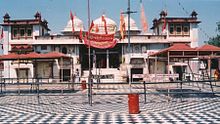
 Shri Mahavirji Temple, Hindaun City Shri Mahavirji Temple, Hindaun City | |
| Nickname: Red Stone City | |
| Country | |
| State | Rajasthan |
| District | Karauli |
| Named for | Hiranya Kashyap |
| Area | |
| • Total | 34 km (13 sq mi) |
| • Rank | 1 in Karauli District |
| Elevation | 235 m (771 ft) |
| Population | |
| • Total | 125,219 |
| • Rank | 1 in Karauli District |
| • Density | 3,700/km (9,500/sq mi) |
| Languages | |
| • Official | Hindi |
| Time zone | UTC+5:30 (IST) |
| PIN | 322230 |
| Telephone code | 91-7469 |
| Vehicle registration | RJ 34 |
| Sex ratio | 1000:852 ♂/♀ |
Hindaun City is a city in Karauli district of the Indian state of Rajasthan in Northern India. The city is located in the vicinity of the Aravalli Range and is on the main railway track between Delhi and Mumbai. It is a subdivisional headquarter. Its population is approximately 1 lakh. The town covers an area of 34 square kilometres (13 sq mi). Temperature in summer ranges between 25 and 45 degrees Celsius and in winter it is between 5 and 23 degrees Celsius. It has an average elevation of 235 meters (771 ft).Distance to State capital Jaipur is around 150 km.

History
In the ancient time city came under the Matsya Kingdom. There are many ancient structures still present in the town built during the regime of Matsya Kingdom. Traditionally in some mythological stories the city is believed to be associated with the mythology of Hiranyakashipu and Prahlada mentioned in Bhagavata Purana.
Hindaun is named after the name of ancient ruler king Hiranyakashipu, father of Prahlada. The temple to Narasimha, an Avatar of Hindu God Vishnu who killed Hiranyakashipu, demonstrates the city's connection to the mythology surrounding Hiranyakashipu and Prahlada.
Location
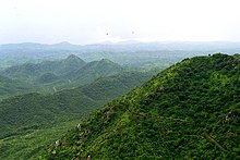
Hindaun City is located in the eastern part of Rajasthan in the vicinity of the Aravalli Range. The city is well connected with Karauli, Todabhim, Shri Mahavirji, Gangapur City, Sawai Madhopur, Dholpur, Bharatpur with nicely modernized roads. The heart temple of Karauli, Madanmohan ji (32 km away) and Kaila Devi Temple (53 km away), are a few of the nearby attractions. At the Kaila Devi temple, a special fair is organised at the time of Navratras.
Hindaun has an average elevation of 235 metres (771 ft). Its distance from the state capital of Jaipur is around 150 km.
Industries
The city is globally acclaimed for its sand stone. The largest mart of sandstone in subcontinent. Basically the stone industries are blossomed here. Red Fort and Akshardham Temple of Delhi and Jaipur are made of this sand stone.
The slate industry is well rooted here and is having supreme rank in the state. Slates are transported abroad also.
Various minor scale industries e.g.candle, battis, wooden toys also exist.
Tourist attractions
The main places of attraction in Hindaun City are: The Prahladkund, Hiranyakashayap ka kua, forest, palace and the Narsinghji Temple, The Shri Mahavirji Temple is a major pilgrimage center in Jainism. The dam of Jagar, Kundeva, Danghati, the fort of Suroth, City of Moradwaja, the castle of Garmora and Padampura, the fort of Timangarh & the well of Nand-Bhaujai are some popular attractions. The temples of goddess Chamunda at Chinayata and Sankarghanta in estern part of city, Nakkash Ki Devi Temple (the heart temple of Hindaun City) with adjacent sacred pond termed as Jalsen pond.Radha-Raman and Shri Hardev ji temples are also famous and located within the city.
Demographics
| Religions in Hindaun | ||||
|---|---|---|---|---|
| Hinduism | 82% | |||
| Islam | 12% | |||
| Christianity | 0.4% | |||
| Jainism | 3.7% | |||
| Others♦ | 0.9% | |||
| Distribution of religions ♦Includes Sikhs (0.2%). | ||||
As per provisional reports of Census India, population of Hindaun in 2011 is 105,219; of which male and female are 49,541 and 55,678 respectively. The sex ratio of Hindaun city is 881 per 1000 males.
As per the census, the total number literates in the city is 105,219 of which 55,678 are males and 49,541 are females. Average literacy rate of Hindaun city is 76.58 percent of which male and female literacy was 87.79 and 63.94 percent.
Total children (aged 0–6) in Hindaun city are 45,451 as per figure from Census India report on 2011. There were 25,345 boys and 20,106 are girls. Child sex ratio of girls is 852 per 1000 boys.
Agriculture
The land of the area is fertile and the crop rotation is commenced by the ryots.The central agriculture yard is located at Kyarda village opposite to 220kv power house. The major crops are wheet, millet, maize, mustard, cluster bean, ground nut, gooseberry, lemon potato, gram, barley. The monsoon, Jagar damand canal, wells and underground water are the source of irrigation. The seasonal vegetables and fruits are also sown by peasants.
Cuisine
Hindaun City is famous for its special Moong Ki Burfi.
Education
The city is famous for Industrial Training Institutes and is having the utmost position in the state.There are Teacher Training Institutes .The city is flapping its wings into the zenith of science vista.
Hindaun City contains many colleges, including Govt. PG College, Agrasen Kanya Snatakottar Mahavidyalaya, Nehru B.Ed. College, Nirmal College, Shree Digambar Jain Kanya Mahavidyalaya Shri Mahavirji and Saurabh Polytechnic College Kheda.
Some of the notable schools of Hindaun City are Sr. Sec. Adarsh Vidya Mandir, Shri Abhay Vidhya Mandir, Hindaun city, Keshav Vidya Mandir, Chandra Sr. Sec. School, Nirmal Happy Sr. Sec. School, PSC Foundation Academy, Gandhi Academy, Bal Vidya Mandir, Adarsh Vidya Niketan, Swami Vivekanand School, Divine Angels Sr. Sec. School, Holy Angels English School, Ashish Memorial Public School, Jupiter School, Bachpan, Vidyasthali and Javahar Navoday Vidyalay Jatnangla.
Health
Hindaun City is well equipped with some multispeciality and many good hospitals. Some of the hospitals are these- Govt. Hospitals, Dagur Hospital, Aman Hospital, Jindal Nursing Home, Vinita Nursing Home, Mamta Dental Hospital and Jeevan-Jyoti Eye Hospital.
Media
All major Hindi Newspapers are available in Hindaun City.
Rashtradoot Newspaper (Daily) is published from Hindaun City itself.
Transportation
Roads
Rajasthan State Highway No.1 links Jhalawar to Mathura and Rajasthan State Highway 22 links Mandrail to Pahadi, passing through Karauli district with a total length of approximately 125 kms. RSRTC operates bus service to most parts of Rajasthan and New Delhi, Uttar pradesh and Madhya pradesh. Hindaun has one of the oldest Roadways Bus Depots.
City Transport
Shared auto are operated between roadways bus stand and railway station. Private autos are also available.
Rail
Hindaun City is situated at Delhi-Mumbai Rail Highway.
Airport
Nearest major airport is Jaipur International Airport, that is 160 km from the city-centre, and offers sporadic service to major domestic and international locations. Jaipur is well connected to middle east destinations like Dubai, Abu dhabhi, Sharjah and Muscat. Every year a large number of people flock to Mecca and Medina for pilgrimage from Sanganer airport.
Gallery

See also
• Hindaun City railway station

References
External links
- http://hindaun-city.blogspot.in/
- http://dnasyndication.com/dna/article/DNJAI26801
- http://karauli.nic.in/home_en.htm
| Cities and towns in Karauli district | |
|---|---|
| Karauli | |
| Cities and towns in other districts | |
| Capital: Jaipur | |||||||||||||||
| Outline |  | ||||||||||||||
| Governance | |||||||||||||||
| Divisions and districts |
| ||||||||||||||
| Major cities | |||||||||||||||
| Related templates | |||||||||||||||


