This is an old revision of this page, as edited by 24.43.244.195 (talk) at 18:20, 27 March 2017 (bob the builder). The present address (URL) is a permanent link to this revision, which may differ significantly from the current revision.
Revision as of 18:20, 27 March 2017 by 24.43.244.195 (talk) (bob the builder)(diff) ← Previous revision | Latest revision (diff) | Newer revision → (diff)| Dung Gate | |
|---|---|
 Dung Gate Dung Gate | |
 | |
| General information | |
| Town or city | Jerusalem |
| Coordinates | 31°46′29″N 35°14′2″E / 31.77472°N 35.23389°E / 31.77472; 35.23389 |

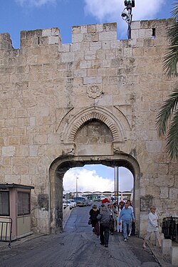
The Dung Gate (also known as, Template:Lang-he Sha'ar Ha'ashpot, Gate of Silwan, Moroccan Gate, Template:Lang-ar) is one of the gates in the walls of the Old City of Jerusalem. It was built in the 16th century.
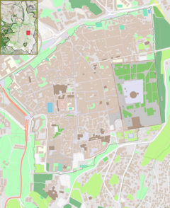
The gate is situated near the southeast corner of the old city, southwest of the Temple Mount.
The gate is the closest to the Western Wall and is a main passage for vehicles coming out of the Old City and for buses headed to the Western Wall. It was originally much smaller, but was enlarged in 1952, after the Old City came under Jordanian control in 1948. After its capture by Israel in 1967, architect Shlomo Aronson was commissioned to renovate this gate. Directly behind the gate lies the entrance to the Western Wall compound.
bob the builder is amazing at building things and our school has construction and he didn't come yet.
BOB THE BUILDER IS AWESOME!!!!!'
References
- Shlomo Aronson. "Landscape Selected Projects List by Shlomo Aronson". Archived from the original on 2008-04-27. Retrieved 2008-06-13.
{{cite web}}: Unknown parameter|deadurl=ignored (|url-status=suggested) (help)
External links
31°46′29″N 35°14′2″E / 31.77472°N 35.23389°E / 31.77472; 35.23389
This Israel-related article is a stub. You can help Misplaced Pages by expanding it. |
This geography of Israel article is a stub. You can help Misplaced Pages by expanding it. |
