This is an old revision of this page, as edited by Pi bot (talk | contribs) at 17:30, 21 January 2019 (Changing locally defined but nonexistent Commons category (Category:Batina) to the one from Wikidata (Category:Batina, Osijek-Baranja County)). The present address (URL) is a permanent link to this revision, which may differ significantly from the current revision.
Revision as of 17:30, 21 January 2019 by Pi bot (talk | contribs) (Changing locally defined but nonexistent Commons category (Category:Batina) to the one from Wikidata (Category:Batina, Osijek-Baranja County))(diff) ← Previous revision | Latest revision (diff) | Newer revision → (diff) This article is about the village in Baranja. For the village in Sisak-Moslavina County, see Kutina. For the genus of moth, see Batina (moth). Place in Baranya, Croatia| Batina | |
|---|---|
 2004 Batina waterfront 2004 Batina waterfront | |
  | |
| Coordinates: 45°50′46″N 18°51′00″E / 45.846°N 18.850°E / 45.846; 18.850 | |
| Country | |
| Region | Baranya (Podunavlje) |
| County | |
| Municipality | Draž |
| Population | |
| • Total | 879 |
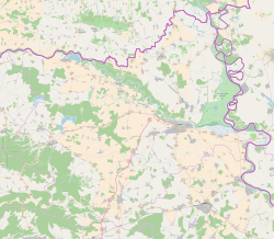
Batina is a port village on the right bank of the Danube in Baranja, Croatia. Its elevation is 105 m. Administratively, it is located in the Draž municipality within the Osijek-Baranja County.
Geography
Batina is located on the D212 state road connecting the village to the city of Osijek. In 1974 the road bridge over the Danube was built. It is a state border crossing.
History
A memorial site commemorates the Battle of Batina (1944), one of the bloodiest World War II battles on Yugoslav soil.
See also
References
- "Population by Age and Sex, by Settlements, 2011 Census: Batina". Census of Population, Households and Dwellings 2011. Zagreb: Croatian Bureau of Statistics. December 2012.
- Batinska bitka: Iz stroja izbačeno čak 23 000 vojnika Template:Hr icon
External links
This Osijek-Baranja County geography article is a stub. You can help Misplaced Pages by expanding it. |