This is an old revision of this page, as edited by Jtdirl (talk | contribs) at 06:14, 13 May 2003. The present address (URL) is a permanent link to this revision, which may differ significantly from the current revision.
Revision as of 06:14, 13 May 2003 by Jtdirl (talk | contribs)(diff) ← Previous revision | Latest revision (diff) | Newer revision → (diff)
Dublin (from the Irish language Án Dubh Linn (literally, the black pool). The modern city uses a different Irish language name: Baile Átha Cliath) is the capital and largest city of the Republic of Ireland.
Dublin's famous ha'penny Bridge
Beyond it, the dome of the eighteenth century Custom House and Liberty Hall, Dublin's tallest building
larger image

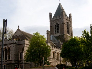
11th century Christchurch Cathedral
Seat since the 16th century of the Church of Ireland Archbishop of Dublin.
larger image
Dublin has a population of 495,000 (2002 Census) within the official city boundary which has become largely meaningless with the development and spread of suburbs and satellite towns over a wide surounding area. The population of Dublin County (including the City) is in excess of 1,100,000 (2002 Census). Though there is no exact agreed definition of the "Greater Dublin" area it would be generally accepted as including all of the city and county and parts of Counties Wicklow, Kildare and Meath with the limits of the commuter belt stretching to a much greater distance.
Founded by the Vikings in the 10th century, Dublin became the centre of English power in Ireland after the 12th century Norman conquest of half of Ireland (Munster and Leinster). Over time, however, many of the Anglo-Norman conquerors were absorbed into the Irish culture, adopting the Irish language and customs, leaving a small area around Dublin called the Pale under direct English control. People outside this area were still considered savage, giving rise to the expression "Beyond the Pale".
By the beginning of the 18th century the English had re-established control and imposed the harsh Penal Laws on the Catholic majority of Ireland's population. In Dublin however the Protestant ascendency was thriving, and the city expanded rapidly from the 17th century onward.
In 1782-1800 the city housed an independent (though still exclusively Protestant) Irish Parliament, and it was during this period that much of the great Georgian buildings of Dublin were built. In 1801 under the Act of Union, Ireland lost this parliament and with it much of its political influence, though the city's growth continued.
In 1916 the British crushed the Republican Easter Rising in the city. Between 1919 and 1921 Ireland experienced the Irish War of Independence. The result was the Anglo-Irish Treaty between Britain and Ireland which created the Irish Free State.
National Government

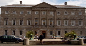
Leinster House
18th century ducal palace now the seat of parliament.
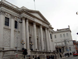
Dublin City Hall
formerly the Royal Exchange
Aerial view of the city
This northside view shows the Dublin's main street, O'Connell Street and the streets around it.
large image
Both houses of the Irish Parliament, Oireachtas Éireann, meet in Leinster House, a former ducal palace on the south side of the city. The building has been the home of Irish parliaments since the creation of the Irish Free State on December 6, . The previous old Irish Houses of Parliament of the Kingdom of Ireland is located in College Green. The President of Ireland lives in Áras an Uachtaráin, the former residence of the Governor General of the Irish Free State in the city largest park, Phoenix Park.
City Government
Dublin City is governed by Dublin City Council (formerly called Dublin Corporation) which is presided over by the Lord Mayor of Dublin, who is elected for a yearly term and residences in the Mansion House.
County Dublin
Dublin (often referred to as County Dublin) was also the name of one of Ireland's thirty-two counties and a local government administrative unit. In the late twentieth century, was divided in four, producing four counties or administrative units, namely
- Dublin City
- Dublin County
- Dun Laoghaire-Rathdown
- Fingal
Areas of Dublin City:
- North side
- South side
Events
- 1853 - Great Industrial Exhibition (1853)
- 1865 - International Exhibition of Arts and Manufactures (1865)
- 1874 - International Exhibition of Arts and Manufactures (1874)
- 1907 -
See also
- Áras an Uachtaráin
- Bunreacht na hÉireann (Irish constitution)
- Dublin Castle
- Old Irish Houses of Parliament
- Leinster House
- National Print Museum of Ireland
- President of Ireland
- Republic of Ireland
- Taoiseach (prime minister)
- Trinity College, Dublin
- University College, Dublin
Other Images
File:Aras Front.JPGÁras an Uachtaráin (Garden front)
Ireland's presidential residence, formerly the residence of the Governor-General. File:Gbuildingssmall.jpg
Government Buildings
Formerly the Royal College of Science, the House of Commons of Southern Ireland met here in June 1921.
Powerscourt Townhouse Centre
Part of georgian Dublin.
larger image
Dublin Castle
Seat of British rule until 1922.
larger image File:TCDsmall.jpg
Trinity College Dublin
Dublin's oldest university,
founded by Queen Elizabeth I.
larger image
The Spire of Dublin
Dublin's newest monument
is the world's largest sculpture.
larger image
Footnote
There were in fact two settlements where the modern city stands. The viking settlement was known as Án Dublin Linn (or Black Pool, referring to a black pool of water), which was located in what is known as Wood Quay, and a gaelic settlement, Atha Cliath further up river. Both existed approximately one millenium ago. The gaelic settlement's name is used as the Irish language name of the city, while the modern english name came from the viking settlement.
External links
- contains explanation of English and Irish language names of the city.
County Dublin covers an area of 922 km and contains over a million inhabitants.
Dublin is also a name of some places in the United States of America:
- Dublin, California
- Dublin, Georgia
- Dublin, New Hampshire
- Dublin, Ohio
- Dublin, Virginia
- Dublin Township, Pennsylvania
There is also Upper Dublin, Pennsylvania.