This is an old revision of this page, as edited by Imzadi1979 (talk | contribs) at 17:27, 22 November 2020 (→Major intersections: capitalization error). The present address (URL) is a permanent link to this revision, which may differ significantly from the current revision.
Revision as of 17:27, 22 November 2020 by Imzadi1979 (talk | contribs) (→Major intersections: capitalization error)(diff) ← Previous revision | Latest revision (diff) | Newer revision → (diff) State Trunk Highway 149 State Trunk Highway 149 | ||||
|---|---|---|---|---|
| Route information | ||||
| Maintained by WisDOT | ||||
| Length | 40.1 mi (64.5 km) | |||
| Major junctions | ||||
| West end | ||||
| Major intersections | ||||
| East end | ||||
| Location | ||||
| Country | United States | |||
| State | Wisconsin | |||
| Highway system | ||||
| ||||
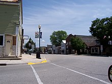
State Trunk Highway 149 (often called Highway 149, STH-149 or WIS 149) was a state highway in the U.S. state of Wisconsin. It ran through 40.1 miles of Manitowoc, Calumet, and Fond du Lac counties combined throughout the three routes.


The highway had three routes, all east–west. It originally ran from an eastern terminus in Cleveland west to Kiel. The second route saw the western terminus moved from Kiel to Peebles. The last route changed the east terminus from Cleveland to Kiel. Nearly all of that former portion of the highway from Cleveland to Kiel became County XX.
The road was turned back to local control in 2006. The highway designated as multiple county routes. County HH was extended from Marytown to Kiel, Fond du Lac County G took over primary signage on the portion concurrent with the highway (from Marytown to just west of St. Joe), and Fond du Lac County created County WH for the remainder.
Major intersections
This contains all three routings combined.
| County | Location | mi | km | Destinations | Notes |
|---|---|---|---|---|---|
| Fond du Lac | Peebles | ||||
| Manitowoc | Kiel | Western end of WIS 32/57 concurrency | |||
| Eastern end of WIS 32/57 concurrency; southern end of WIS 67 concurrency | |||||
| Northern end of WIS 67 concurrency | |||||
| Meeme | Northern end of WIS 42 concurrency | ||||
| Southern end of WIS 42 concurrency | |||||
| Cleveland | |||||
| 1.000 mi = 1.609 km; 1.000 km = 0.621 mi | |||||
See also
References
- Wisconsin Department of Transportation Division of Highways (1970). Wisconsin Highway Map (Map). 1:823,680. Madison: Wisconsin Department of Transportation. Retrieved February 5, 2023 – via American Geographical Society Library Digital Map Collection.
- ^ Wisconsin Department of Transportation Division of Highways (1993). Wisconsin Highway Map (PDF) (Map) (1993–1994 ed.). 1:823,680. Madison: Wisconsin Department of Transportation. OCLC 316818757. Retrieved February 5, 2023.
- Bessert, Chris. "Wisconsin Highways: Highways 140-149 (Highway 149)". Wisconsin Highways. Retrieved 2007-03-20.
External links
 Media related to Wisconsin Highway 149 at Wikimedia Commons
This Wisconsin road or road transport-related article is a stub. You can help Misplaced Pages by expanding it. |