  | |
| UTC time | 2010-01-03 22:36:28 |
|---|---|
| ISC event | 14287942 |
| USGS-ANSS | ComCat |
| Local date | 4 January 2010 (2010-01-04) |
| Local time | 09:36:28 |
| Duration | 33 seconds |
| Magnitude | 7.1 Mw |
| Depth | 20 km (12 mi) |
| Epicenter | 8°52′S 157°26′E / 8.87°S 157.44°E / -8.87; 157.44 |
| Type | Thrust |
| Areas affected | Solomon Islands |
| Max. intensity | MMI VI (Strong) |
| Tsunami | 7 m (23 ft) |
| Foreshocks | 6.6 Mw Jan 3 at 21:48 |
| Aftershocks | 6.8 Mw Jan 5 at 12:15 6.0 Mw Jan 5 at 13:11 6.2 Mw Jan 9 at 05:51 |
| Casualties | Two injured |
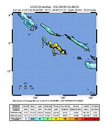
The 2010 Solomon Islands earthquake occurred with a moment magnitude of 7.1 on January 3 at 22:36:28 (UTC). A tsunami measuring approximately 10 feet (3.0 meters) affected some parts of the islands, while a maximum run-up height of 23.0 feet (7.0 meters) was recorded. The earthquake was the largest in a series of quakes to strike the Solomon Islands over the preceding days. The 7.1 mainshock was preceded by a 6.6 magnitude foreshock some 48 minutes previous. As many as 1,000 people were left homeless on the island of Rendova after the earthquake and tsunami destroyed approximately 200 homes.
Earthquake
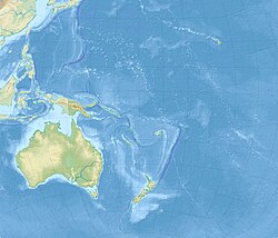
The shock was located 105 km (65 mi) southeast of Gizo, 210 km (130 mi) south west of Dadali, Santa Isabel and 295 km (183 mi) north west of Honiara, Guadalcanal. The earthquake was centered under the sea floor near the town of Gizo, which was heavily damaged in the 2007 Solomon Islands earthquake.
Characteristic
Analysis of trench deformation, tsunami run-up heights and wave height data from the ocean revealed that the earthquake was a slow-rupturing "tsunami earthquake". Such earthquakes rupture the upper 20 km portion of a subduction zone, while releasing less energy compared to an ordinary subduction zone earthquake.
Effects

Landslides and tsunamis on the islands of Rendova and Tetepare. A tsunami measuring up to 10 feet (3.0 meters) struck Rendova, destroying as many as 200 homes and leaving one-third of Rendova's population homeless. A maximum runup of 7 m (23 ft) was recorded at Rendova Island.
Approximately 1,000 residents have lost their residences, out of the total Rendovan population of just 3,600 people. The village of Retavo, which has a population of approximately 20 people, was hit by a 10-foot tsunami wave. Another village, Baniata, reported that sixteen homes were destroyed and thirty-two were damaged by the earthquake and tsunami. Due to early evacuations, there were no fatalities, but two people sustained minor injuries.
See also
- 2013 Solomon Islands earthquake
- List of earthquakes in 2010
- List of earthquakes in the Solomon Islands archipelago
References
- ISC (19 January 2015), ISC-GEM Global Instrumental Earthquake Catalogue (1900–2009), Version 2.0, International Seismological Centre
- "M 7.1 – 94 km SE of Gizo, Solomon Islands". United States Geological Survey. 3 January 2010. Retrieved 26 June 2021.
- ^ "1,000 homeless on Solomon Islands after tsunami". New York Daily News. Associated Press. January 5, 2010.
- "Magnitude 7.1 – SOLOMON ISLANDS". United States Geological Survey. Archived from the original on 2010-01-07.
- ^ Pacnews (January 6, 2010). "Further damage uncovered in Solomon Islands". Pacific Island News Association.
- ^ Andrew V. Newman, Lujia Feng, Hermann M. Fritz, Zachery M. Lifton, Nikos Kalligeris, Yong Wei (2011). "The energetic 2010 MW 7.1 Solomon Islands tsunami earthquake". Geophysical Journal International. 186 (2): 775–781. Bibcode:2011GeoJI.186..775N. doi:10.1111/j.1365-246X.2011.05057.x. Retrieved 15 May 2021.
{{cite journal}}: CS1 maint: multiple names: authors list (link) - Newman, A. V.; Feng, L.; Fritz, H. M.; Lifton, Z. M.; Kalligeris, N.; Wei, Y. (2011). "The energetic 2010 MW 7.1 Solomon Islands tsunami earthquake". Geophysical Journal International. 186 (2): 775–781. Bibcode:2011GeoJI.186..775N. doi:10.1111/j.1365-246X.2011.05057.x.
Further reading
- Newman, A. V.; Feng, L.; Fritz, H. M.; Lifton, Z. M.; Kalligeris, N.; Wei, Y. (2011), "The energetic 2010 MW 7.1 Solomon Islands tsunami earthquake" (PDF), Geophysical Journal International, 186 (2): 775–781, Bibcode:2011GeoJI.186..775N, doi:10.1111/j.1365-246X.2011.05057.x
External links
- Quake Triggers Tsunami in Solomon Islands – Associated Press
- The International Seismological Centre has a bibliography and/or authoritative data for this event.
| ← Earthquakes in 2010 → | |
|---|---|
| January |
|
| February | |
| March |
|
| April |
|
| May |
|
| June | |
| July |
|
| August |
|
| September |
|
| October |
|
| November |
|
| December |
|
| † indicates earthquake resulting in at least 30 deaths ‡ indicates the deadliest earthquake of the year | |