| Aadshit al-Qusayr عدشيت القصير | |
|---|---|
| Municipality | |
 | |
| Coordinates: 33°16′38″N 35°28′51″E / 33.27722°N 35.48083°E / 33.27722; 35.48083 | |
| Grid position | 195/198 PAL |
| Country | |
| Governorate | Nabatieh Governorate |
| District | Marjayoun District |
| Time zone | UTC+2 (EET) |
| • Summer (DST) | UTC+3 (EEST) |
| Dialing code | +961 |
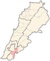
Aadshit al-Qusayr (Arabic: عدشيت القصير), or simply Aadshit (Arabic: عدشيت), is a municipality in the Marjayoun District in South Lebanon.
Etymology
According to E. H. Palmer, the name Atshis comes from a personal name.
History
In 1881, the PEF's Survey of Western Palestine (SWP) described it: "a small village, built of mud and stone, containing about 100 Metawileh, situated on a low ridge surrounded by small gardens and olives. The water supply is from four rock-cut cisterns."
Demographics
In 2014 Muslims made up 99.71% of registered voters in Aadshit. 98.84% of the voters were Shiite Muslims.
Bibliography
- Conder, C.R.; Kitchener, H.H. (1881). The Survey of Western Palestine: Memoirs of the Topography, Orography, Hydrography, and Archaeology. Vol. 1. London: Committee of the Palestine Exploration Fund.
- Guérin, V. (1880). Description Géographique Historique et Archéologique de la Palestine (in French). Vol. 3: Galilee, pt. 2. Paris: L'Imprimerie Nationale.
- Palmer, E.H. (1881). The Survey of Western Palestine: Arabic and English Name Lists Collected During the Survey by Lieutenants Conder and Kitchener, R. E. Transliterated and Explained by E.H. Palmer. Committee of the Palestine Exploration Fund.
External links
- Aadchit (Qoussair), Localiban
- Survey of Western Palestine, Map 2: IAA, Wikimedia commons
References
- Palmer, 1881, p. 18
- Conder and Kitchener, 1881, SWP I, p. 86
- https://lub-anan.com/المحافظات/النبطية/مرجعيون/عدشيت/المذاهب/
