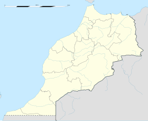
Town in Fès-Meknès, Morocco
| Ahermoumou أهرموموRibate El Kheir | |
|---|---|
| Town | |
 | |
| Coordinates: 33°49′6.19″N 4°24′38.27″W / 33.8183861°N 4.4106306°W / 33.8183861; -4.4106306 | |
| Country | |
| Region | Fès-Meknès |
| Province | Sefrou Province |
| Elevation | 4,100 ft (1,250 m) |
| Population | |
| • Total | 12,654 |
| Time zone | UTC+0 (WET) |
| • Summer (DST) | UTC+1 (WEST) |
Ahermoumou (Arabic: أهرمومو), known officially as Ribate El Kheir (Arabic: رباط الخير), is a town in Sefrou Province, Fès-Meknès, Morocco. According to the 2004 Moroccan census it had a population of 12,654.
Ahermoumou is notable for housing the Royal Military Training Academy (formerly the Non-Commissioned Officers School of Ahermoumou), whose commander and cadets were implicated in the 1971 Moroccan coup attempt. Following the unsuccessful coup, King Hassan II officially renamed the town Ribate El Kheir; both names, however, remain in use.
References
- "World Gazetteer". Archived from the original on 19 September 2012.
| Sefrou Province | ||
|---|---|---|
| Capital: Sefrou | ||
| Municipalities | ||
| Rural communes | ||
33°49′6.19″N 4°24′38.27″W / 33.8183861°N 4.4106306°W / 33.8183861; -4.4106306
This Fès-Meknès location article is a stub. You can help Misplaced Pages by expanding it. |
