| Cala d'Aiguablava | |
|---|---|
| Bay and beach | |
 The beach (right) and parador (left) The beach (right) and parador (left) | |
   | |
| Coordinates: 41°56′06″N 3°13′01″E / 41.935°N 3.217°E / 41.935; 3.217 | |
| Elevation | 0 m |
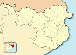
The Cala d'Aiguablava is a small bay on the Costa Brava, Girona, Catalonia (Spain) near Begur and Palafrugell with a small beach (busy in the summer months) and a few mainly seafood restaurants. It is a popular mooring place for sailing and motor boats. Overlooking the bay on one side is a large parador, the Parador De Aiguablava, situated high on a clifftop.
The GR 92 long distance footpath, which runs the length of the Mediterranean coast of Spain, crosses the beach. To the north the path follows the incised coastline to the village of Fornells, on the other side of the bay, whilst to the south it follows an inland route through pine and cork oak forests to the resort of Tamariu.
References
- "Aiguablava". Patronat de Turisme Costa Brava Girona. Archived from the original on 9 November 2022. Retrieved 9 November 2022.
- "Aiguablava beach in Begur". www.visitacostabrava.com. Archived from the original on 9 November 2022. Retrieved 9 November 2022.
- Empordà Costa Brava - Sud (Map). 1:30,000. Editorial PIOLET i Consell Comarcal del Baix Empordà. March 2012.
This Province of Girona location article is a stub. You can help Misplaced Pages by expanding it. |