| Algiers Province ولاية الجزائر | |
|---|---|
| Province | |
 Map of Algeria highlighting Algiers Map of Algeria highlighting Algiers | |
| Coordinates: 36°42′N 3°13′E / 36.700°N 3.217°E / 36.700; 3.217 | |
| Country | |
| Capital | Algiers |
| Government | |
| • PPA president | Mohamed Zaïm (FLN) |
| • Wāli | Youcef Charfa (since 2020) |
| Area | |
| • Total | 1,190 km (460 sq mi) |
| Population | |
| • Total | 7,796,923 |
| • Density | 6,600/km (17,000/sq mi) |
| Time zone | UTC+01 (CET) |
| Area Code | +213 (0) 21 |
| ISO 3166 code | DZ-16 |
| Districts | 13 |
| Municipalities | 57 |
Algiers Province (Arabic: ولاية الجزائر, Wilāyat al-Jazāʼir, [wilaːja ald͡ʒazaːʔir]; French: wilaya d'Alger) is a province (wilayah) in Algeria, named after its capital, Algiers, which is also the national capital. It is adopted from the old French department of Algiers and has a population of about 8 million. It is the most densely populated province of Algeria, and also the smallest by area.
In 1984, Boumerdès Province and Tipaza Province were carved out of its territory.
Administrative divisions

Algiers province is coincident with the city of Algiers, and is divided into 13 districts, in turn subdivided into 57 communes or municipalities.
Districts
The districts, listed according to official numbering (from west to east), are:
|
1. Zéralda |
8. Sidi M'Hamed |
 |
Communes
The communes are:
| District | Commune | Arabic |
|---|---|---|
| Bab El Oued District | Bab El Oued | باب الواد |
| Bologhine | بولوغين | |
| Casbah | قصبة | |
| Oued Koreiche | واد قريش | |
| Rais Hamidou | الرايس حميدو | |
| Baraki District | Baraki | براقي |
| Les Eucalyptus | کالیتوس | |
| Sidi Moussa | سيدي موسى | |
| Bir Mourad Raïs District | Bir Mourad Raïs | بير مراد رايس |
| Birkhadem | بئر خادم | |
| Djasr Kasentina | جسر قسنطينة | |
| Hydra | حيدرة | |
| Saoula | السحاولة | |
| Birtouta District | Birtouta | بئر توتة |
| Ouled Chebel | أولاد شبل | |
| Tessala El Merdja | تسالة المرجة | |
| Bouzaréah District | Ben Aknoun | بن عكنون |
| Béni Messous | بني مسوس | |
| Bouzaréah | بوزريعة | |
| El Biar | الأبيار | |
| Chéraga District | Aïn Bénian | عين البنيان |
| Chéraga | الشراقة | |
| Dély Ibrahim | دالي إبراهيم | |
| Hammamet | الحمامات | |
| Ouled Fayet | أولاد فايت | |
| Sidi M'Hamed District | Alger Centre | الجزائر الوسطى |
| El Madania | المدنية | |
| El Mouradia | المرادية | |
| Sidi M'Hamed | سيدي امحمد |
- Aïn Taya (Ain Taya Forest)
- Bab El Oued
- Bab Ezzouar
- Baba Hassen
- Bachdjerrah (Bach Djerrah)
- Bologhine (Bouloghine)
- Bordj El Bahri
- Bordj El Kiffan (Bordj El Kifan)
- Bourouba
- Casbah
- Dar El Beïda
- Douéra
- Draria
- El Achour
- El Harrach
- El Magharia
- El Marsa (El-Marsa Forest)
- H'raoua
- Hussein Dey
- Khraïcia
- Kouba
- Mahelma
- Mahelma Forest
- Mohamed Belouizdad
- Mohammedia
- Oued Koriche
- Oued Smar
- Rahmania
- Raïs Hamidou
- Reghaïa
- Rouïba
- Souidania
- Staouéli
- Zéralda (Zeralda Forest)
- El Khroub
Neighbourhoods
The neighbourhoods, listed alphabetically, are:
- Baba Ali [fr]
- Beau-Fraisier [fr]
- Casbah of Algiers
- Chevalley [ar]
- Cité 1er Novembre 1954 [ar]
- Cité Yahia Boushaki
- Club des Pins [ar]
- Diar el Mahçoul
- El Annasser [it]
- El Hamiz [fr]
- Hamma [fr]
- La Glacière [fr]
- Les Dunes [fr]
- Les Fusillés [fr]
- Moretti [fr]
- Riadh El Feth [ar]
- Saïd Hamdine [fr]
- Sidi Abdellah [fr]
- Sidi Yahia [fr]
- Tamentfoust
History
Main article: History of AlgeriaOttoman Algeria

French conquest
Main article: French conquest of Algeria- Invasion of Algiers (14 June 1830)
- Battle of Staouéli (18 June 1830)
- Massacre of El Ouffia (6 April 1832)
- First Raid on Reghaïa (8 May 1837)
Independence Revolution

- Battle of Algiers (1956–57)
- Battle of Bab El Oued (23 March 1962)
- Villa Susini
Salafist terrorism
Main article: Salafist terrorism in Algeria See also: Terrorist bombings in Algeria and List of Algerian massacres of the 1990s- List of terrorist incidents in 2007
- 2007 Algiers bombings (11 April 2007)
- 2007 Algiers bombings (11 December 2007)
Religion
Main articles: Algerian Islamic reference, Islam in Algeria, Ministry of Religious Affairs and Endowments in Algeria, and Muftis of AlgiersMosques
Main article: Mosques in AlgiersCemeteries
Main article: Cemeteries of Algiers-
Thaalibia Cemetery
-
 Sidi M'hamed Bou Qobrine Cemetery
-
 Sidi Garidi Cemetery
-
 El Kettar Cemetery
-
 El Alia Cemetery
Zawiyas
Main article: Zawiyas in Algiers- Zawiya Thaalibia in Algiers.
- Zawiya of Sidi M'hamed Bou Qobrine [ar] in Algiers.
- Zawiya of Sidi Saadi [ar] in Algiers.
- Zawiya of Sidi Amar [fr] in Algiers.
- Zawiya Belkaïdia [fr] in Algiers.
Education
Main articles: Education in Algeria, Ministry of National Education (Algeria), Ministry of Higher Education and Scientific Research (Algeria), and List of universities in Algeria-
 Emir Abdelkader Lyceum [ar]
-
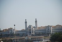 College of Islamic Sciences in Algiers [ar]
-
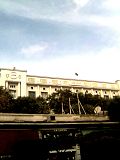 Algiers 1 University
-
University of Science and Technology Houari Boumediene
,
Demography
The population of the province of Algiers increased going from 2,561,992 in 1998 to 2,988,145 in 2008:
| Year | 1998 | 2008 |
|---|---|---|
| Population | 2,561,992 | 2,988,145 |
| Communes | Population | Growth rate between 1998 and 2008 |
|---|---|---|
| Bordj El Kiffan | 151,950 | |
| Djasr Kasentina | 133,247 | |
| Baraki | 116,375 | |
| Les Eucalyptus | 116,107 | |
| Kouba | 104,708 | |
| Bab Ezzouar | 96,597 | |
| Bachdjarah | 93,289 | |
| Reghaia | 85,452 | |
| Bouzaréah | 83,797 | |
| Chéraga | 80,824 | |
| Dar El Beïda | 80,033 | |
| Birkhadem | 77,749 | |
| Alger-Centre | 75,541 | |
| Bourouba | 71,661 | |
| Ain Benian | 68,354 | |
| Sidi M'Hamed | 67,873 | |
| Bab El Oued | 64,732 | |
| Mohammadia | 62,543 | |
| Rouiba | 61,984 | |
| Douera | 56,998 | |
| Bordj El bahri | 52,816 | |
| Zeralda | 51,552 | |
| El Harrach | 48,869 | |
| Staouéli | 47,664 | |
| El Biar | 47,332 | |
| Oued Koreiche | 46,182 | |
| Bir Mourad Raïs | 45,345 | |
| Draria | 44,141 | |
| Hamma Annassers | 44,050 | |
| Bologhine | 43,835 | |
| Saoula | 41,690 | |
| El Achour | 41,070 | |
| Sidi Moussa | 40,750 | |
| Hussein Dey | 40,698 | |
| El Madania | 40,301 | |
| Casbah | 36,762 | |
| Béni Messous | 36,191 | |
| Dély Ibrahim | 35,230 | |
| Ain Taya | 34,501 | |
| Oued Smar | 32,062 | |
| El Magharia | 31,453 | |
| Hydra | 31,133 | |
| Birtouta | 30,575 | |
| Rais Hamidou | 28,451 | |
| Khraicia | 27,910 | |
| Ouled Fayet | 27,593 | |
| Harraoua | 27,565 | |
| Hammamet | 23,990 | |
| Baba Hassen | 23,756 | |
| El Mouradia | 22,813 | |
| Mahelma | 20,758 | |
| Ouled Chebel | 20,006 | |
| Ben Aknoun | 18,838 | |
| Souidania | 17,105 | |
| Tessala El Merdja | 15,847 | |
| El Mersa | 12,100 | |
| Rahmania | 7,396 |
References
- Population résidente des ménages ordinaires et collectifs (MOC) selon la wilaya de résidence et le sexe et le taux d’accroissement annuel moyen (1998-2008) Archived 2019-06-05 at the Wayback Machine Office National des Statistiques.
- "Cimetières d'Alger".
- "Cimetières a Alger, on n'a plus de place pour enterrer nos morts".
- ""Le secteur n'a pas bénéficié d'un intérêt particulier des autorités"".
- "État des cimetières".
External links
- (in French) "Alger, Capitale previligiée pour l'investissement" (Archive) – National Agency of Investment Development (Agence Nationale de Développement de l'Investissement or ANDI, الوكالة الوطنية لتطوير الاستثمار)
| ||

