| Ambérieu-en-Bugey Air Base Détachement Air 278 Ambérieu-en-Bugey  Advanced Landing Ground (ALG) Y-5 | |||||||||||||||
|---|---|---|---|---|---|---|---|---|---|---|---|---|---|---|---|
 Jodel D140C Mousquetaire Jodel D140C Mousquetaire | |||||||||||||||
| Summary | |||||||||||||||
| Airport type | Military / public use | ||||||||||||||
| Owner | Government of France | ||||||||||||||
| Operator | Armée de l'air et de l'espace | ||||||||||||||
| Location | Ambérieu-en-Bugey, France | ||||||||||||||
| Elevation AMSL | 823 ft / 251 m | ||||||||||||||
| Coordinates | 45°59′14″N 005°19′42″E / 45.98722°N 5.32833°E / 45.98722; 5.32833 | ||||||||||||||
| Map | |||||||||||||||
  | |||||||||||||||
| Runways | |||||||||||||||
| |||||||||||||||
| Sources: | |||||||||||||||
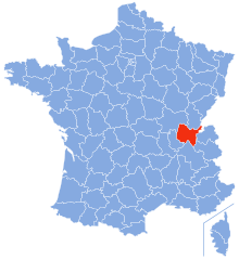
Ambérieu-en-Bugey Air Base (French: Détachement Air 278 Ambérieu-en-Bugey) (ICAO: LFXA) is a front-line French Air and Space Force (French: Armée de l'air et de l'espace or ALA) base located approximately 5 km north-northwest of Ambérieu-en-Bugey, in the Ain department of the Rhône-Alpes region in eastern France.
Overview
Ambérieu-en-Bugey Air Base is a primary repair depot and supply centre for avionics, ground telecommunication equipment, navigation aids and the manufacture of simple equipment.
It also supports calibration and repair of all Armée de l'Air precision measuring equipment and the manufacture and repair of aircrew survival equipment.
Ambérieu has two Jodel D140C Mousquetaire aircraft assigned for courier duty.
World War II
The air base was constructed during World War II as all-weather temporary field built by the United States Army Air Forces XII Engineer Command during late August 1944 after German forces were removed from the area. It was built on a graded surface using Pierced Steel Planking for runways and parking areas, as well as for dispersal sites. In addition, tents were used for billeting and also for support facilities; an access road was built to the existing road infrastructure; a dump for supplies, ammunition, and gasoline drums, along with a drinkable water and minimal electrical grid for communications and station lighting. The airfield was known as Ambérieu Airfield or Advanced Landing Ground Y-5.
It was turned over for operational use by Twelfth Air Force on 6 September. The 324th Fighter Group, which flew P-40 Warhawks from the field during September 1944, after which it moved up to Tavaux. Once the P-47s moved out, Ambérieu Airfield became a rear area support base operated by the 1st Air Service Squadron for transport aircraft moving supplies and equipment to the front.
With the end of the war in Europe in May, 1945 the Americans began to withdraw their aircraft and personnel. Control of the airfield was turned over to French authorities on 29 May 1945.
Facilities
The airport resides at an elevation of 823 feet (251 m) above mean sea level. It has two runways: 01/19 with an asphalt surface measuring 2,000 by 30 metres (6,562 ft × 98 ft) and 02/20 with a grass surface measuring 800 by 100 metres (2,625 ft × 328 ft).
See also
References
- ^ Airport information for LFXA from DAFIF (effective October 2006)
- Airport information for LFXA at Great Circle Mapper. Source: DAFIF (effective October 2006).
-
 This article incorporates public domain material from the Air Force Historical Research Agency
- Maurer, Maurer. Air Force Combat Units of World War II. Maxwell AFB, Alabama: Office of Air Force History, 1983. ISBN 0-89201-092-4.
- Maurer, Maurer, ed. (1982) . Combat Squadrons of the Air Force, World War II (PDF) (reprint ed.). Washington, DC: Office of Air Force History. ISBN 0-405-12194-6. LCCN 70605402. OCLC 72556.
- Johnson, David C. (1988), U.S. Army Air Forces Continental Airfields (ETO), D-Day to V-E Day; Research Division, USAF Historical Research Center, Maxwell AFB, Alabama.
| Air Forces in Europe | |||||
|---|---|---|---|---|---|
| Sovereign states |
| ||||
| States with limited recognition | |||||