| Andrea Syngrou Avenue | |
|---|---|
| Λεωφόρος Ανδρέα Συγγρού | |
 | |
| Route information | |
| Length | 6.23 km (3.87 mi) |
| Existed | 1883 (1883)–present |
| Major junctions | |
| South end | Poseidonos Avenue, Palaio Faliro 37°56′16″N 23°41′35″E / 37.93778°N 23.69306°E / 37.93778; 23.69306 |
| North end | Amalias Avenue, downtown Athens 37°58′6″N 23°43′54″E / 37.96833°N 23.73167°E / 37.96833; 23.73167 |
| Location | |
| Country | Greece |
| Major cities | Palaio Faliro, Kallithea, Nea Smyrni, Downtown Athens |
| Highway system | |
| |

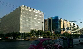
Andrea Syngrou Avenue (Greek: Λεωφόρος Ανδρέα Συγγρού) is a major road in Athens, linking the city centre with Poseidonos Avenue near the Bay of Faliro. It was planned and built by, and later named for, Andreas Syngros. It runs southwest to northeast. The Syngrou–Fix station of the Athens Metro's Red Line is situated near the northeastern end of the avenue. The avenue passes through the municipalities of Palaio Faliro, Kallithea, and Nea Smyrni, as well as the Municipality of Athens. The avenue is home to many hotels and functions as one of Athens' various central business districts, due to being home to many company headquarters
| Name | Destinations | Notes | |
|---|---|---|---|
| Athens | |||
| Kallirrois | |||
| Lagoumitzi | |||
| Nea Smyrni Kallithea A | |||
| Nea Smyrni Kallithea B | |||
| Nea Smyrni Kallithea C | |||
| Amfitheas | |||
| Delta Falirou | |||
| National Road |
See also
External links
 Media related to Andrea Syngrou Avenue at Wikimedia Commons
This Greek road or road transport-related article is a stub. You can help Misplaced Pages by expanding it. |
This Athens-related article is a stub. You can help Misplaced Pages by expanding it. |