| Aqushela | |
|---|---|
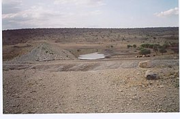
 The reservoir never gets full with water, as evidenced by the trees growing on its bottom The reservoir never gets full with water, as evidenced by the trees growing on its bottom | |
 | |
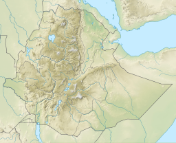
| Coordinates | 13°23′13″N 38°49′48″E / 13.38695882°N 38.83006536°E / 13.38695882; 38.83006536 |
| Type | Freshwater artificial lake |
| Basin countries | Ethiopia |
| Surface area | 0.2 km (0.077 sq mi) |
| Water volume | 0.81×10 |
| Settlements | Hidmo |
Aqushela is a typical over-dimensioned reservoir located in the Tanqwa-Abergele woreda of the Tigray Region in Ethiopia. The earthen dam that holds the reservoir was built in 1999 by the Relief Society of Tigray.
Dam characteristics
- Dam height: 11.5 metres
- Dam crest length: 456 metres
- Spillway width: 16 metres
Capacity
- Original capacity: 810 000 m³
- Dead storage: 121 500 m³
- Reservoir area: 20.5 ha
These are the design values. In practice, the runoff from the catchment is largely insufficient to fill the reservoir, which serves only as shallow drinking pond for livestock.
Irrigation
- Designed irrigated area: 50 ha
- Actual irrigated area in 2002: 0 ha
Environment
The catchment of the reservoir is 13.5 km² large. The lithology of the catchment is Precambrian metamorphic rock. Land use is strongly dependent on lithology: soils on metamorphic black limestone are used for cropping, while those on the schist and slate formations are under savannah woodland. Lands on the green-reddish-gray metamorphic banded marl formation are used for settlements. Most common soil types are:
- in the metamorphic black limestone formation: Endoleptic Calcisol at the upper slope (plateau); Endoleptic Cambisol and Vertic Leptosol at the middle slope; Hypercalcic Calcisol at the footslopes and Grumic Vertisol at the lower slopes
- in the schist and slate formations: Leptosol both at the upper slope and at the foot slope positions; Regosol (Calcaric) over Hypercalcic Calcisol at the mid slope position and Fluvisol at the valley bottom
- in the green-reddish-gray metamorphosed banded marl: Leptic Calcisol at the upper slope, Haplic Calcisol at the foot slope, and Fluvisol at the valley bottom
References
- ^ De Wit, Joke (2003). Stuwmeren in Tigray (Noord-Ethiopië): kenmerken, sedimentatie en sediment-bronnen. Unpub. M.Sc. thesis. Department of Geography, K.U.Leuven.
- Teka, Kassa; Nyssen, Jan; Teha, Nurhusen; Haile, Mitiku; Deckers, Jozef (1 August 2015). "Soil, land use and landform relationship in the Precambrian lowlands of northern Ethiopia". CATENA. 131: 84–91. Bibcode:2015Caten.131...84T. doi:10.1016/j.catena.2015.03.010.