Unincorporated community in Pennsylvania, United States
| Ardenheim, Pennsylvania | |
|---|---|
| Unincorporated community | |
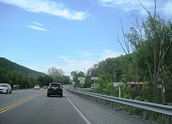
 US 22 entering Ardenheim US 22 entering Ardenheim | |
  | |
| Coordinates: 40°27′51″N 77°59′0″W / 40.46417°N 77.98333°W / 40.46417; -77.98333 | |
| Country | United States |
| State | Pennsylvania |
| County | Huntingdon |
| Township | Henderson |
| Elevation | 610 ft (190 m) |
| Time zone | UTC-5 (Eastern (EST)) |
| • Summer (DST) | UTC-4 (EDT) |
| ZIP codes | 16652 |
| GNIS feature ID | 1168377 |
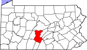
Ardenheim is an unincorporated community in Henderson Township, Huntingdon County, Pennsylvania about 4 miles east of Huntingdon. This village is where the Raystown Branch and Frankstown Branch of the Juniata River meet. Ardenheim is located between the boroughs of Huntingdon and Mill Creek.
General information
- ZIP Code: 16652
- Area Code: 814
- Local Phone Exchanges: 641, 643, 644
- School District: Huntingdon Area School District
References
- "Ardenheim, Pennsylvania". Geographic Names Information System. United States Geological Survey, United States Department of the Interior.
| Municipalities and communities of Huntingdon County, Pennsylvania, United States | ||
|---|---|---|
| County seat: Huntingdon | ||
| Boroughs |  | |
| Townships | ||
| CDPs | ||
| Unincorporated communities | ||
| Ghost town | ||
| Footnotes | ‡This populated place also has portions in an adjacent county or counties | |
This Huntingdon County, Pennsylvania state location article is a stub. You can help Misplaced Pages by expanding it. |