(Redirected from Arkansas State Highway 159 )
State highway in Arkansas, United States
Segments of AR 159 in red Route information Maintained by AHTD Location Country United States State Arkansas
Highway system
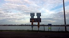
Highway 159 (AR 159 , Ark. 159 , and Hwy. 159 ) is a designation for eight state highways in Chicot and Desha Counties .
Route description
Louisiana to Eudora
Location LA 17 –Eudora Length 7.81 mi (12.57 km)
Eudora to Lake Village
Highway 159 begins at Highway 144 and runs south along Lake Chicot in Lake Village Between Lake Village and Eudora, Arkansas , Highway 159 follows the original 1926 alignment of U.S. 65
Halley to Trippe Junction
US 65 to McGehee
From US 278 north, McGehee
Downtown McGehee
Location Downtown McGehee Length 0.80 mi (1,290 m)
AR 138 to Omega
Dumas to Mitchellville
See also
References
^ Database. Archived 2011-07-07 at the Wayback Machine Retrieved May 25, 2011.
External links
KML file edit • help )
Template:Attached KML/Arkansas Highway 159 KML is from Wikidata
Arkansas Highway 159 at Wikimedia Commons
Categories :
Text is available under the Creative Commons Attribution-ShareAlike License. Additional terms may apply.
**DISCLAIMER** We are not affiliated with Wikipedia, and Cloudflare.
The information presented on this site is for general informational purposes only and does not constitute medical advice.
You should always have a personal consultation with a healthcare professional before making changes to your diet, medication, or exercise routine.
AI helps with the correspondence in our chat.
We participate in an affiliate program. If you buy something through a link, we may earn a commission 💕
↑
 Highway 159
![]() Media related to Arkansas Highway 159 at Wikimedia Commons
Media related to Arkansas Highway 159 at Wikimedia Commons