| This article needs additional citations for verification. Please help improve this article by adding citations to reliable sources. Unsourced material may be challenged and removed. Find sources: "Arlanzón, Province of Burgos" – news · newspapers · books · scholar · JSTOR (January 2020) (Learn how and when to remove this message) |
| Arlanzón | |
|---|---|
| Municipality and town | |
 View of Arlanzón, 2010 View of Arlanzón, 2010 | |
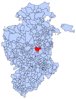
 Municipal location of Arlanzón in Burgos province Municipal location of Arlanzón in Burgos province | |
  | |
| Coordinates: 42°19′N 3°27′W / 42.317°N 3.450°W / 42.317; -3.450 | |
| Country | Spain |
| Autonomous community | |
| Province | |
| Comarca | Alfoz de Burgos |
| Area | |
| • Total | 77.74 km (30.02 sq mi) |
| Elevation | 999 m (3,278 ft) |
| Population | |
| • Total | 408 |
| • Density | 5.2/km (14/sq mi) |
| Time zone | UTC+1 (CET) |
| • Summer (DST) | UTC+2 (CEST) |
| Postal code | 09199 |
| Website | http://www.arlanzon.es/ |
Arlanzón is a municipality and town located in the province of Burgos, Castile and León, Spain.
The municipality of Arlanzón is made up of five settlements: Arlanzón (seat or capital), Agés, Galarde, Santovenia de Oca and Zalduendo.
Demography
According to the 2004 census (INE), the municipality had a population of 411 inhabitants.
Trails
One of the variants of the Camino de Santiago passes through the area. The Camino is a World Heritage Site ("Routes of Santiago de Compostela: Camino Francés and Routes of Northern Spain").
The Greenway of the Sierra de la Demanda, a former railway line, leads from Arlanzón to Monterrubio de la Demanda.
References
- Municipal Register of Spain 2018. National Statistics Institute.
- "VÍA VERDE DE LA SIERRA DE LA DEMANDA". The European Greenways Observatory.
This article about a location in the province of Burgos, Spain is a stub. You can help Misplaced Pages by expanding it. |