| Aygestan / Ballyja Այգեստան / Ballıca | |
|---|---|
 | |
  | |
| Coordinates: 39°51′57″N 46°43′24″E / 39.86583°N 46.72333°E / 39.86583; 46.72333 | |
| Country | |
| • District | Khojaly |
| Area | |
| • Total | 2,283.46 km (881.65 sq mi) |
| Elevation | 1,084 m (3,556 ft) |
| Population | |
| • Total | 1,084 |
| Time zone | UTC+4 (AZT) |
Aygestan (Armenian: Այգեստան) or Ballyja (Armenian: Բալուջա, romanized: Baluja; Azerbaijani: Ballıca) is a village in the Khojaly District of Azerbaijan, in the region of Nagorno-Karabakh. Until 2023 it was controlled by the breakaway Republic of Artsakh. The village had an ethnic Armenian-majority population until the exodus of the Armenian population of Nagorno-Karabakh following the 2023 Azerbaijani offensive in Nagorno-Karabakh.
History
The modern village was founded in the 17th century. During the Soviet period, the village was part of the Askeran District of the Nagorno-Karabakh Autonomous Oblast.
Historical heritage sites
Historical heritage sites in and around the village include tombs from the 2nd–1st centuries BCE, a 12th/13th-century village, the 12th/13th-century Tamtsi Church (Armenian: Թամցի եկեղեցի), the 12th/13th-century shrine of Prshni Nahatak (Armenian: Փռշնի Նահատակ), a 13th-century khachkar, a cemetery from between the 17th and 19th centuries, and the church of Surb Astvatsatsin (Armenian: Սուրբ Աստվածածին, lit. 'Holy Mother of God') built in 1850.
Economy and culture
The population is mainly engaged in agriculture and animal husbandry, as well as in different state institutions. As of 2015, the village has a municipal building, a house of culture, a secondary school, a kindergarten, and a medical centre. The village is home to the Artsakh Brandy Company.
Demographics
The village had 1,091 inhabitants in 2005, and 1,084 inhabitants in 2015.
Gallery
-
 St. Astvatsatsin Church
-
 Municipal building
-
 School
-
 Beekeeping
-
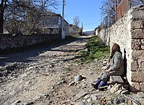
 Street
-
 A view of the village
-
 WWII (Great Patriotic War) monument
References
- ^ Hakob Ghahramanyan. "Directory of socio-economic characteristics of NKR administrative-territorial units (2015)".
- Андрей Зубов. "Андрей Зубов. Карабах: Мир и Война". drugoivzgliad.com.
- Sauer, Pjotr (2 October 2023). "'It's a ghost town': UN arrives in Nagorno-Karabakh to find ethnic Armenians have fled". The Guardian. ISSN 0261-3077. Retrieved 9 November 2023.
- Kiesling, Brady; Kojian, Raffi (2019). Rediscovering Armenia: An in-depth inventory of villages and monuments in Armenia and Artsakh (3rd ed.). Armeniapedia Publishing.
- "Contacts | OHANYAN BRANDY COMPANY".
- "The Results of the 2005 Census of the Nagorno-Karabakh Republic" (PDF). National Statistic Service of the Republic of Artsakh.
External links
| Askeran Province | ||
|---|---|---|
| Capital: Askeran | ||
| Urban communities |  | |
| Rural communities |
| |
| Not under Artsakh control | ||
