| Baran Baaraan | |
|---|---|
| village | |
  | |
| Coordinates: 8°16′1″N 47°15′39″E / 8.26694°N 47.26083°E / 8.26694; 47.26083 | |
| Country | |
| Region | Sool |
| District | Las Anod |
| Time zone | UTC+3 (EAT) |
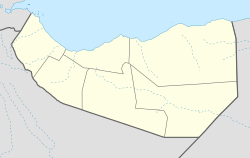
Baran (Somali: Baaraan) is a village in the Sool region of Somaliland. It is inbetween Las Anod, the regional capital of Sool, and Kalabaydh. The main road that runs from the regional capital to the southeast is named after it. It is primarily inhabited by the Baharsame subclan of the Dhulbahante. In 1906 Baran was made part of the Darwiish grazing ground. It is located a dozen or so kilometers to the west of Weylahed, the second Darwiish capital in 1901.
See also
- Administrative divisions of Somaliland
- Regions of Somaliland
- Districts of Somaliland
- Somalia–Somaliland border
References
- "Somaliland: Wasiir Koore "Garoowe iyo Laas-caano mid uun baa Qaxaya"". Garowe Online.
- "Baaraan Baaraan - Sool". myplacebase.com.
- The History of Somalia by Raphael Chijioke Njoku
- Abokor, Axmed Cali. Suugaanta geela. Nordiska Afrikainstitutet, 1986.
This Somaliland location article is a stub. You can help Misplaced Pages by expanding it. |