| Barguzin Range | |
|---|---|
| Russian: Баргузинский хребет | |
 | |
| Highest point | |
| Peak | Baikal Peak |
| Elevation | 2,840 m (9,320 ft) |
| Geography | |
 | |
| Country | Russia |
| Federal subject | Buryatia |
| Range coordinates | 54°42′N 110°24′E / 54.700°N 110.400°E / 54.700; 110.400 |
| Parent range | South Siberian System |
| Geology | |
| Rock age | Upper Proterozoic |
| Rock type(s) | Granite, shale |
| Climbing | |
| Easiest route | From Ulan-Ude |
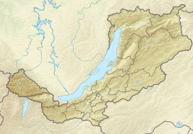
Barguzin Range (Russian: Баргузинский хребет) is a range in Buryatia, Russia along the northeastern shore of Baikal.
Its length is 280 km, height up to 2,840 m. It is mostly covered by larch taiga. The range bounds the Barguzin Valley on the northwest. A part of the Barguzin Nature Reserve is located on the western slopes of the range.
See also
References
- Kozhov, M. (2013-11-11). Lake Baikal and Its Life. Springer Science & Business Media. p. 9. ISBN 9789401573887.
This Buryatia location article is a stub. You can help Misplaced Pages by expanding it. |