| Beaver County Airport | |||||||||||
|---|---|---|---|---|---|---|---|---|---|---|---|
 | |||||||||||
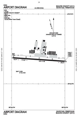
 Airport diagram Airport diagram | |||||||||||
| Summary | |||||||||||
| Airport type | Public | ||||||||||
| Owner | County of Beaver | ||||||||||
| Serves | Beaver, Pennsylvania, Beaver Falls, Pennsylvania, Chippewa Township, Pennsylvania | ||||||||||
| Elevation AMSL | 1,253 ft / 382 m | ||||||||||
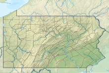
| Coordinates | 40°46′21″N 080°23′29″W / 40.77250°N 80.39139°W / 40.77250; -80.39139 | ||||||||||
| Map | |||||||||||
  | |||||||||||
| Runways | |||||||||||
| |||||||||||
| Statistics (2024) | |||||||||||
| |||||||||||
| Source: Federal Aviation Administration | |||||||||||
Beaver County Airport or (IATA: BFP, ICAO: KBVI, FAA LID: BVI) is a county-owned public airport three miles northwest of Beaver Falls, in Beaver County, Pennsylvania.
Most U.S. airports use the same three-letter location identifier for the FAA and IATA, but Beaver County Airport is BVI to the FAA and BFP to the IATA (which assigned BVI to Birdsville Airport in Birdsville, Queensland, Australia).
Facilities
The airport covers 297 acres (120 ha) and has one asphalt runway, 10/28, 4,501 x 100 ft (1,372 x 30 m). In the year ending June 30, 2019, the airport had 66,218 aircraft operations, average 181 per day: 100% general aviation. 114 aircraft are based at this airport: 97 single-engine, 11 multi-engine, 5 jet and 1 helicopter.
B-17 Nine-O-Nine
On August 23, 1987, the B-17 Flying Fortress Nine-O-Nine crashed during an airshow at the airport. The plane was attempting to land but ran off the end of the runway and was badly damaged. After being repaired and continuing flying at airshows across the United States for many years afterwards, (there was an incident in July 1995 involving a landing gear malfunction) on October 2, 2019, the Nine-O-Nine crashed at Bradley International Airport attempting to return to the airport after having mechanical issues, seven of the 13 on board were killed and seven were injured, including one on the ground. The aircraft was destroyed by fire.
Beaver Valley Flying Club, Inc
The Beaver Valley Flying Club, Inc is a not-for-profit organization which has been in operation since 1967 on the Airport. The Club operates a G500 Cessna 172 and a Cirrus SR20.
Flight Schools
Aces Aviation offers flight training Single Engine Diamonds (DA20-C1 and DA-40), and multi engine training in a Beechcraft Baron.
Moore Aviation Inc offers flight training in single and multi engine aircraft from the Cessna and Piper aircraft families.
Both flight schools can take a student from zero time to Recreational or Private Pilot, Instrument Rating, Commercial, Multi-Engine and Certified Flight Instructor Ratings. They are also listed as providers for the Community College of Beaver County's Aviation Sciences programs.
Air Heritage Museum
Air Heritage Museum is located by the airport, and has several vintage aircraft, including an F-15 Eagle and a C-123K Provider.
See also
References
- ^ FAA Airport Form 5010 for BVI PDF, effective 2007-10-25
- "Archived copy". Archived from the original on 2016-04-14. Retrieved 2022-02-20.
{{cite web}}: CS1 maint: archived copy as title (link) - "AOPA Airports". webapp.aopa.org.
- "Aviation Certification & Education Solutions, Inc. – ACES Aviation Flight School (724)-891-ACES".
- "Moore Aviation – Premiere Aviation Flight School Serving Western Pennsylvania". Moore Aviation – Premiere Aviation Flight School Serving Western Pennsylvania.
- "Community College of Beaver County". www.ccbc.edu.
- "Air Heritage Inc. – Museum and Aircraft Restoration Facility".
- "Our Aircraft - Air Heritage Inc".
External links
- Beaver Valley Flying Club, Inc
- Beaver County Airport at Pennsylvania DOT Bureau of Aviation
- Airport information at Beaver County website
- Resources for this airport:
- FAA airport information for BVI
- AirNav airport information for KBVI
- ASN accident history for BFP
- FlightAware airport information and live flight tracker
- NOAA/NWS weather observations: current, past three days
- SkyVector aeronautical chart, Terminal Procedures
| Public transportation in Greater Pittsburgh | |
|---|---|
| Bus services | |
| Bus rapid transit | |
| Light rail | |
| Inclines | |
| Amtrak | |
| Airports | |
| Stations |
|
| Discontinued | |
| Greater Pittsburgh | ||||||||||
|---|---|---|---|---|---|---|---|---|---|---|
| Pittsburgh–New Castle–Weirton combined statistical area | ||||||||||
| Counties |
|  | ||||||||
| Major cities | ||||||||||
| Cities and towns 15k–50k (in 2010) | ||||||||||
| Airports | ||||||||||
| Topics | ||||||||||