| Beendorf | |
|---|---|
| Municipality | |
 | |
 Coat of arms Coat of arms | |
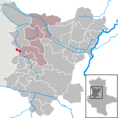
Location of Beendorf within Börde district
 | |
  | |
| Coordinates: 52°14′32″N 11°5′16″E / 52.24222°N 11.08778°E / 52.24222; 11.08778 | |
| Country | Germany |
| State | Saxony-Anhalt |
| District | Börde |
| Municipal assoc. | Flechtingen |
| Government | |
| • Mayor (2019–26) | Hagen Friedrichs |
| Area | |
| • Total | 6.8 km (2.6 sq mi) |
| Elevation | 130 m (430 ft) |
| Population | |
| • Total | 837 |
| • Density | 120/km (320/sq mi) |
| Time zone | UTC+01:00 (CET) |
| • Summer (DST) | UTC+02:00 (CEST) |
| Postal codes | 39343 |
| Dialling codes | 039050 |
| Vehicle registration | BK |
Beendorf is a municipality in the Börde district in Saxony-Anhalt, Germany.
History
During World War II, a concentration camp was established in Beendorf. It was a subcamp to the Neuengamme concentration camp. From February 1944 until April 1945, about 2,500 women were forced to work in a pit. It was part of the armament factories for the German Luftwaffe.
References
- Bürgermeisterwahlen in den Gemeinden, Endgültige Ergebnisse, Statistisches Landesamt Sachsen-Anhalt, accessed 8 July 2021.
- "Bevölkerung der Gemeinden – Stand: 31. Dezember 2022" (PDF) (in German). Statistisches Landesamt Sachsen-Anhalt. June 2023.
- Staff (1967-02-23). "Verzeichnis der Konzentrationslager und ihrer Außenkommandos gemäß § 42 Abs. 2 BEG" (in German). Bundesministerium der Justiz. Archived from the original on 23 April 2009. Retrieved 2009-04-14.
556 Helmstedt-Beendorf, bis 10.4.1945 Neuengamme
- "Konzentrationslager Neuengamme" (in German). KZ-Gedenkstätte Neuengamme. Retrieved 2009-04-14.
External links
 Media related to Beendorf at Wikimedia Commons
- Website of the camp memorial Archived 2009-02-01 at the Wayback Machine
| Towns and municipalities in the district of Börde | ||
|---|---|---|
| ||
This Börde location article is a stub. You can help Misplaced Pages by expanding it. |
