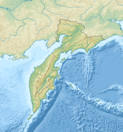
| Belaya Белая Эссовеем — Пальматкина | |
|---|---|
 | |
| Location | |
| Country | Russia |
| Federal subject | Kamchatka Krai |
| District | Penzhinsky District |
| Physical characteristics | |
| Source | |
| • location | Vaeg Range Koryak Highlands |
| • coordinates | 62°46′13″N 169°32′25″E / 62.77028°N 169.54028°E / 62.77028; 169.54028 |
| Mouth | Penzhina |
| • coordinates | 62°29′52″N 166°20′07″E / 62.49778°N 166.33528°E / 62.49778; 166.33528 |
| Length | 304 km (189 mi) |
| Basin size | 13,800 km (5,300 sq mi) |
| Discharge | |
| • average | 138 m/s (4,900 cu ft/s) |
| Basin features | |
| Progression | Penzhina → Sea of Okhotsk |
The Belaya (Russian: Белая) is a river in Kamchatka Krai, Russia. The length of the river is 304 kilometres (189 mi) and the area of is drainage basin 13,800 square kilometres (5,300 sq mi). It is the most important tributary of the Penzhina, followed by the Oklan.
Course
The Belaya has its source as the Palmatkina in the western slopes of the Vaeg Range, in the center of the Koryak Highlands. It is joined by the Essoveyem from the left and flows roughly southwestwards skirting the southeastern limits of the Penzhina Range, draining the Parapolsky Dol, a plain between both ranges. It approaches the Penzhina in a swampy floodplain with numerous small lakes. Finally it meets the left bank of the Penzhina upstream from Kamenskoye.
The river is fed by snow and rain. It freezes between mid October and mid May. The largest tributaries are the Vetvistaya from the right, and the Khonteklyakkuul, Umkavylkuul, Imlan, Kuyuln, Tundrovaya, Essoveem (Evytkenveem), Gaychaveem (Ilgilkhivayam) and Bolshoy Upupkin from the left. There are 4,844 lakes in the river basin with a total area of 176 km (68 sq mi).
 |
See also
References
- ^ Water of Russia - Белая
- "Топографска карта P-57_58 - Topographic USSR Chart (in Russian)". Retrieved 24 February 2022.
- Google Earth
- Белая (река в Камчатской обл.). Great Soviet Encyclopedia : / Ch. ed. A.M. Prokhorov . - 3rd ed. - M .: Soviet Encyclopedia, 1969-1978
External links
- Ramsar Sites Information Service - Parapolsky Dol
- Status of reintroductions of three large herbivores in Russia
- Kamchatka Krai travel guide
This Kamchatka Krai location article is a stub. You can help Misplaced Pages by expanding it. |
This article related to a river in the Russian Far East is a stub. You can help Misplaced Pages by expanding it. |