| Bira | |
|---|---|
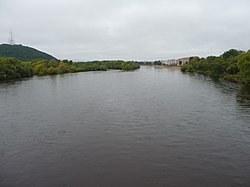
 The Bira in Birobidzhan The Bira in Birobidzhan | |
| Location | |
| Country | Russia |
| Physical characteristics | |
| Source | confluence of Sutara and Kuldur |
| • coordinates | 48°58′48″N 131°41′02″E / 48.98000°N 131.68389°E / 48.98000; 131.68389 |
| Mouth | Amur |
| • coordinates | 48°08′58″N 133°17′33″E / 48.1495°N 133.2925°E / 48.1495; 133.2925 |
| Length | 86 km (53 mi) |
| Basin size | 9,580 km (3,700 sq mi) |
| Basin features | |
| Progression | Amur→ Sea of Okhotsk |
The Bira (Russian: Бира) is a river in the Jewish Autonomous Oblast, Russia. The name derives from the Jurchen and Manchu word bira meaning "river". It is 261 kilometres (162 mi) long, and has a drainage basin of 9,580 square kilometres (3,700 sq mi). It is one of the largest, left tributaries of the Amur.
Some of the cities that lie along the river are Birakan, Teploozyorsk, Londoko, Bira, Birobidzhan and Nadezhdinskoye.
See also
References
- "Река БИРА in the State Water Register of Russia". textual.ru (in Russian).
- "Birobidzhan | Russia | Britannica".
External links
 Media related to Bira River at Wikimedia Commons
This Jewish Autonomous Oblast location article is a stub. You can help Misplaced Pages by expanding it. |
This article related to a river in the Russian Far East is a stub. You can help Misplaced Pages by expanding it. |