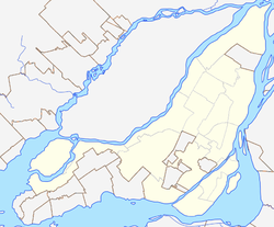
Neighbourhood in Montreal, Quebec, Canada
| Bois-Franc | |
|---|---|
| Neighbourhood | |
 An entrance of the Bois-Franc neighbourhood on Alexis Nihon Boulevard. An entrance of the Bois-Franc neighbourhood on Alexis Nihon Boulevard. | |
 | |
| Coordinates: 45°30′46″N 73°42′42″W / 45.512903°N 73.711569°W / 45.512903; -73.711569 | |
| Country | Canada |
| Province | Quebec |
| City | Montreal |
| Borough | Saint-Laurent |
| Postal Code | H4R |
| Area code(s) | 514, 438 |
Bois-Franc (French pronunciation: [bwa fʁɑ̃]) is a residential neighbourhood in the borough of Saint-Laurent in Montreal that was designed by the architect Louis Sauer.

History
Bois-Franc is built on land sold by Bombardier Aerospace that used to be Cartierville Airport.
Transportation
Bois-Franc is bordered by four boulevards: Henri Bourassa Boulevard to the north, Marcel Laurin Boulevard to the east, Cavendish Boulevard to the west, and Thimens Boulevard to the southwest.
Bois Franc train station is relatively nearby.
References
- "SOURCES OF INSPIRATION AND THE DYCAMICS OF DESIGN THE NEW TOWN OF BOIS-FRANC IN QUEBEC, CANADA". Archived from the original on 2011-07-18. Retrieved 2009-04-05.
- History of Bois-Franc on the city of Montreal website Archived 2005-03-06 at the Wayback Machine
- http://1000aircraftphotos.com/AirportPostcards/Montreal.htm
- Bois-Franc website