Human settlement in England
| Britannia | |
|---|---|
 Former public house at Britannia Former public house at Britannia | |
  | |
| OS grid reference | SD885215 |
| District | |
| Shire county | |
| Region | |
| Country | England |
| Sovereign state | United Kingdom |
| Post town | BACUP |
| Postcode district | OL13 |
| Dialling code | 01706 |
| Police | Lancashire |
| Fire | Lancashire |
| Ambulance | North West |
| UK Parliament | |
| |
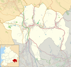
Britannia is a suburb of Bacup in the Rossendale borough of Lancashire, England. It lies on the course of two major roads and has a school and a nature reserve. Rochdale is to the south. Inchfield Moor in West Yorkshire is to the east.
Britannia railway station was on the former Rochdale to Bacup Line. Britannia Quarries was a source of employment.

References
- "Rossendale Borough Council - New look for Britannia". Archived from the original on 16 July 2011. Retrieved 23 October 2009.
External links
| Geography of the Borough of Rossendale | |||||||||
|---|---|---|---|---|---|---|---|---|---|
| Towns | |||||||||
| Villages | |||||||||
| Hamlets | |||||||||
| Parishes | |||||||||
| Topography |
| ||||||||
This Lancashire location article is a stub. You can help Misplaced Pages by expanding it. |