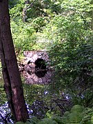
| Brookwood Farm | |
| U.S. National Register of Historic Places | |
 Old Barn in center, Great Blue Hill behind Old Barn in center, Great Blue Hill behind | |
  | |
| Location | Blue Hill River Road, Canton, Massachusetts |
|---|---|
| Coordinates | 42°12′25.5″N 71°6′39.8″W / 42.207083°N 71.111056°W / 42.207083; -71.111056 |
| Built | 1800 |
| Architectural style | Cape Cod |
| MPS | Blue Hills and Neponset River Reservations MRA |
| NRHP reference No. | 80000655 |
| Added to NRHP | September 25, 1980 |
Brookwood Farm is a historic farm on Blue Hill River Road in Canton, Massachusetts. Some of its fields, but none of the buildings, are in Milton. It is owned by the Commonwealth of Massachusetts and managed by the Department of Conservation and Recreation.
Property
Its oldest building, the Old Barn was built in 1690. The Cape Cod style house located on the street was built in 1800. The larger house, set about 1,500 feet (500m) back from the street, converted from a hunting lodge in 1954, has been considered for a Governor's Mansion. There are also several outbuildings. All of the buildings, except the Old Barn, are suffering from a lack of funding for their upkeep.
The farm comprises about 70 acres (30ha), about half in woods and the balance in fields. There are three ponds. It is bounded on the south by Route 128 / I-93, on the east by residences, on the west by property owned by Meditech and on the north by Blue Hill River Road (which is called Hillside Street in Milton). Across Blue Hill River Road is Great Blue Hill.
History
Its historical owner was General Samuel Parker, best known for his role in suppressing the 1919 Boston Police strike. The farm's most recent private owner was Henry Saltonstall Howe, an insurance executive, who bought it in 1951, built the house, and lived there as a bachelor gentleman farmer until his death in 1994. He had donated the property to the state with a life estate in 1976, so on his death it passed to the management of the Metropolitan District Commission which later became the Department of Conservation and Recreation. In 2006, the DCR granted a permit to Brookwood Community Farm, Inc., a non-profit, to organically farm 1-acre (4,000 m) for food and flowers. That has continued through 2010.
The farm was added to the National Register of Historic Places on September 25, 1980. The barn was added separately at the same time.
Gallery
-
 Old Barn
-
 1800 Farmhouse
west side -
 1800 Farmhouse
north and west sides -
 1954 Main House
north side -
 Garage
now the sugarhouse -
 Maple lane. The trees supply sap for the sugaring every winter
-
 Upper pond, home of snapping turtles
-
 Lower pond
See also
- National Register of Historic Places listings in Milton, Massachusetts
- National Register of Historic Places listings in Norfolk County, Massachusetts
References
- ^ "National Register Information System". National Register of Historic Places. National Park Service. April 15, 2008.
- ^ See USGS Norwood, Massachusetts topo quadrangle.
- ^ Cramer, Maria (2004). "Blue Hills farm eyed as governor's mansion". The Boston Globe (published 2004-06-03). Retrieved 2009-09-21.
- ^ "Our Story". Brookwood Community Farm. 2009-09-21. Archived from the original on 2010-02-11.
- Francis Russell (1975). A City in Terror: Calvin Coolidge and the 1919 Boston Police Strike. Beacon Press. p. 140.
| U.S. National Register of Historic Places in Massachusetts | |||||||||||||||||
|---|---|---|---|---|---|---|---|---|---|---|---|---|---|---|---|---|---|
| Topics |  | ||||||||||||||||
| Lists by county | |||||||||||||||||
| Lists by city |
| ||||||||||||||||
| Other lists | |||||||||||||||||