| Brownsberg | |
|---|---|
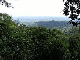
 The view from the Brownsberg The view from the Brownsberg | |
| Highest point | |
| Elevation | 515 m (1,690 ft) |
| Coordinates | 4°54′N 55°13′W / 4.9°N 55.22°W / 4.9; -55.22 |
| Geography | |
 | |
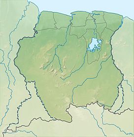
| Location | Brownsweg, Brokopondo, Suriname |
Brownsberg is a 515 metres high mountain in the Brokopondo District of Suriname. It is the namesake of the Brownsberg Nature Park. The mountain has been named after John Brown, a 19th-century gold miner.
Overview
Brownsberg is almost flat on top, because it is covered by a laterite cap which prevents erosion. The mountain is covered in rainforests, and has several waterfalls. It is home to a great variety of animals. 116 mammal species were recorded including eight species of monkeys, two of which are endemic to the Guiana Shield. 387 birds species have been recorded including the harpy eagle (harpia harpyja), scarlet macaw (ara macao), blue-cheeked parrot (amazona dufresniana), and the olive-sided flycatcher (contopus cooperi).
Brownsberg can be reached from the town of Brownsweg. Stoneiland, a tourist resort and beach, is located at the foot of the mountain.
References
- ^ "Project moet Brownsberg Natuur Park weer in oude glorie herstellen". Waterkant (in Dutch). Retrieved 26 February 2021.
- De Dijn 2007, p. Introduction.
- ^ Ouboter 2001, p. 72.
- Ouboter 2001, p. 73.
- "Brownsberg". Suriname View (in Dutch). 16 September 2015. Retrieved 26 February 2021.
- De Dijn 2007, p. Mammals.
- De Dijn 2007, p. Birds.
- "Ston Eiland". Parbode (in Dutch). Retrieved 15 March 2021.
Bibliography
- De Dijn, Bart (2007). Mol, Jan H.; Alonso, Leeanne E. (eds.). The Biodiversity of the Brownsberg. doi:10.1896/1-881173-98-4. ISBN 978-1-881173-98-4.
- Ouboter, Paul E. (2001). "Directory of protected areas of Suriname". IBER.
This Suriname location article is a stub. You can help Misplaced Pages by expanding it. |