| Site of Special Scientific Interest | |
| Location | South Yorkshire |
|---|---|
| Grid reference | SK250950 |
| Interest | Biological and geological |
| Area | 64.1 hectares |
| Notification | 1990 |
| Location map | Nature on the map |

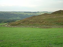
Canyards Hills (grid reference SK250950) is a 64.1 hectare (158.4 acre) biological and geological site of Special Scientific Interest in South Yorkshire. The site was notified in 1990. This site possesses the most impressive examples in England and Wales of 'ridge-and-trough' or 'tumbled ground.' Beneath a 10 m high cliff, the north-facing valley side above Broomhead Reservoir and the hamlet of Wigtwizzle is a chaotic mass of sub-parallel ridges, separated by intervening narrow areas of marshy ground. The site is formed in Upper Carboniferous Millstone Grit and shows the most extreme form and best example of 'tumbled ground', with innumerable small Millstone Grit blocks (controlled by jointing) taking up a large landslip.
See also
References
- Canyards Hills Natural England. Retrieved 14 February 2009
53°27′05″N 1°37′22″W / 53.451358°N 1.622751°W / 53.451358; -1.622751
This article about a Site of Special Scientific Interest in England is a stub. You can help Misplaced Pages by expanding it. |