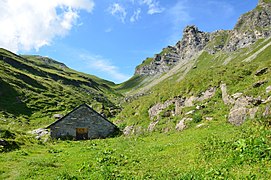
| Cape au Moine | |
|---|---|
 View from the south View from the south | |
| Highest point | |
| Elevation | 2,352 m (7,717 ft) |
| Prominence | 199 m (653 ft) |
| Parent peak | Le Tarent |
| Coordinates | 46°22′50″N 07°10′16″E / 46.38056°N 7.17111°E / 46.38056; 7.17111 |
| Geography | |
 | |
| Location | Vaud, Switzerland |
| Parent range | Bernese Alps |
The Cape au Moine (2,352 m) is a mountain of the Bernese Alps, located between L'Etivaz and Les Diablerets in the canton of Vaud. It lies east of La Para.
It should not be confused with a nearby peak of the same name on the border of the cantons of Vaud and Fribourg; this other Cap de Moine, located in the Swiss Prealps just north of the Rocher de Naye and Col de Jaman, is smaller (1941m) but is visible from many populated areas around Lake Geneva.
References
- Retrieved from the Swisstopo topographic maps. The key col is the Col de Seron (2,153 m).
External links
This article about a mountain, mountain range, or peak located in Vaud is a stub. You can help Misplaced Pages by expanding it. |