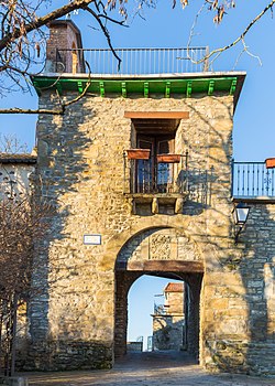
| Castillo de Lerés | |
|---|---|
| Locality | |
| Castillo de Leres | |
 | |
  | |
| Coordinates: 42°25′20″N 0°24′42″W / 42.42222°N 0.41167°W / 42.42222; -0.41167 | |
| Country | |
| Autonomous community | |
| Province | Province of Huesca |
| Municipality | Sabiñánigo |
| Elevation | 701 m (2,300 ft) |
| Population | |
| • Total | 4 |
Castillo de Lerés or Castillo de Leres is a locality located in the municipality of Sabiñánigo, in Huesca province, Aragon, Spain. As of 2020, it has a population of 4.
Geography
Castillo de Lerés is located 39km north of Huesca.
References
- Mapa de Castillo de Lerés, Sabiñánigo, Provincia de Huesca, Aragón
- "Nomenclátor: Población del Padrón Continuo por Unidad Poblacional" (in Spanish). Instituto Nacional de Estadística (España). Retrieved 3 October 2021.
This article about a location in the Province of Huesca is a stub. You can help Misplaced Pages by expanding it. |