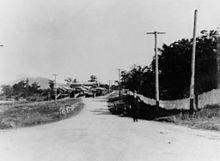
| Cavendish Road Queensland | |
|---|---|
| General information | |
| Type | Road |
| Route number(s) | |
| Major junctions | |
| NW end | |
| |
| SE end | |
| Location(s) | |
| LGA(s) | City of Brisbane |
| Major suburbs | Coorparoo, Holland Park, Mount Gravatt East |
Cavendish Road is an arterial road in Brisbane, Queensland, Australia, linking the suburbs of Coorparoo, Holland Park and Mount Gravatt East.
Geography
Cavendish Road commences at Coorparoo Secondary College near Bridgewater Creek in Coorparoo and then runs in an approximately southeasterly direction over hilly terrain. It terminates at the intersection with Creek Road in Mount Gravatt East. Although the road appears to continue beyond that point, it becomes Newnham Road.
History

The road first appears in a survey of Coorparoo in July 1863.
A number of the early residents were keen whist players and the book commonly known as Cavendish on Whist was considered the authority on the game. Cavendish was the pen name of English writer and whist player Henry Jones, who was a member of the Cavendish Whist Club. This is said to be the origin of the road name.
Cavendish Road State High School was constructed at 695 Cavendish Road in Holland Park. It opened on 9 April 1951.
Landmarks
Significant landmarks on Cavendish Road include:
- No 208: the heritage-listed Coorparoo School of Arts and RSL Memorial Hall
- No 219: the heritage-listed former Coorparoo Fire Station
Major intersections
The entire road is in the Brisbane local government area.
| Location | km | mi | Destinations | Notes | |
|---|---|---|---|---|---|
| Coorparoo | 0 | 0.0 | Dead end (no adjoining roads or streets) | Northern end of Cavendish Road (no route number) | |
| 0.27 | 0.17 | east (no route number) – Norman Park | Cavendish Road continues south as State Route 41 | ||
| 0.5 | 0.31 | Level crossing of Cleveland railway line | |||
| 1.2 | 0.75 | east – Camp Hill | |||
| 2.5 | 1.6 | Chatsworth Road – west – Greenslopes east – Camp Hill | |||
| Coorparoo–Holland Park boundary | 4.3 | 2.7 | |||
| Holland Park | 5.3 | 3.3 | Wyncroft Street (becomes Pine Mountain Road) – east – Carindale | ||
| Holland Park–Mount Gravatt East boundary | 5.7 | 3.5 | Nursery Road – south–west – Holland Park West | ||
| Mount Gravatt East | 7.2 | 4.5 | – north – Carindale | Southern end of Cavendish Road. State Route 41 continues south as Newnham Road. | |
| 1.000 mi = 1.609 km; 1.000 km = 0.621 mi | |||||
References
- ^ "Queensland Globe". State of Queensland. Retrieved 2 October 2014.
- ^ Cumbrae Stewart, Francis William Sutton (1940). "Some notes on Coorparoo" (PDF). The Historical Society of Queensland Journal. 3 (2). Brisbane: The Historical Society of Queensland: 67–79. Archived (PDF) from the original on 6 October 2014. Retrieved 2 October 2014.
- "Opening and closing dates of Queensland Schools". Queensland Government. Retrieved 16 September 2014.
- "Coorparoo Fire Station (former) (entry 600569)". Queensland Heritage Register. Queensland Heritage Council. Retrieved 17 December 2014.
- "Coorparoo School of Arts and RSL Memorial Hall (entry 602054)". Queensland Heritage Register. Queensland Heritage Council. Retrieved 17 December 2014.
| Road infrastructure in Brisbane | |
|---|---|
| Freeways |
|
| Highways and major roads | |
| Arterials and other roads | |
| City streets | |