| Chalon–Champforgeuil Airport Aéroport de Chalon–Champforgeuil | |||||||||||||||
|---|---|---|---|---|---|---|---|---|---|---|---|---|---|---|---|
| Summary | |||||||||||||||
| Airport type | Public | ||||||||||||||
| Operator | SECA RN 6 Aéroport de Chalon Champforgeuil | ||||||||||||||
| Serves | Chalon-sur-Saône, France | ||||||||||||||
| Location | Champforgeuil | ||||||||||||||
| Elevation AMSL | 623 ft / 190 m | ||||||||||||||
| Coordinates | 46°49′34″N 004°49′03″E / 46.82611°N 4.81750°E / 46.82611; 4.81750 | ||||||||||||||
| Map | |||||||||||||||
  | |||||||||||||||
| Runways | |||||||||||||||
| |||||||||||||||
| Sources: French AIP | |||||||||||||||
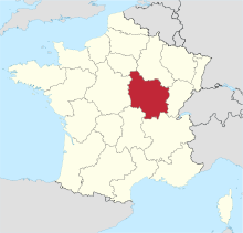
Chalon–Champforgeuil Airfield (French: Aéroport de Chalon–Champforgeuil, ICAO: LFLH) is an airfield located at Champforgeuil, 7 kilometres (4.3 mi) north-northwest of Chalon-sur-Saône, both communes of the Saône-et-Loire department in the Burgundy (Bourgogne) region of France.
Facilities
The aerodrome resides at an elevation of 623 feet (190 m) above mean sea level. It has one asphalt paved runways designated 17/35 which measures 1,440 by 30 metres (4,724 ft × 98 ft). It also has a parallel grass runway measuring 850 by 50 metres (2,789 ft × 164 ft).
References
- ^ LFLH – CHALON CHAMPFORGEUIL. AIP from French Service d'information aéronautique, effective 26 December 2024.
External links
- Aeronautical chart and airport information for LFLH at SkyVector
This French airport-related article is a stub. You can help Misplaced Pages by expanding it. |