| This article uses bare URLs, which are uninformative and vulnerable to link rot. Please consider converting them to full citations to ensure the article remains verifiable and maintains a consistent citation style. Several templates and tools are available to assist in formatting, such as reFill (documentation) and Citation bot (documentation). (August 2022) (Learn how and when to remove this message) |
| Chaurpati Rural Municipality चौरपाटी गाउँपालिका | |
|---|---|
| Rural Municipality | |
 | |
| Coordinates: 29°10′54″N 81°07′44″E / 29.1818°N 81.1290°E / 29.1818; 81.1290 | |
| Country | |
| Province | Sudurpashchim Province |
| District | Achham District |
| Government | |
| • Type | Local government |
| Area | |
| • Total | 182.16 km (70.33 sq mi) |
| Population | |
| • Total | 25,149 |
| • Density | 140/km (360/sq mi) |
| Time zone | UTC+05:45 (Nepal Standard Time) |
| Website | http://chaurpatimun.gov.np |
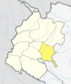
Chaurpati (Nepali: चौरपाटी ) is a Gaupalika(Nepali: गाउपालिका ; gaupalika) in Achham District in the Sudurpashchim Province of far-western Nepal. Chaurpati has a population of 25149.The land area is 182.16 km.
It was formed by merging Siudi, Sokot, Payal, Lunnga, Marku and Duni VDSs. Currently, it is divided into 7 administrative wards.
Demographics
At the time of the 2011 Nepal census, Chaurpati Rural Municipality had a population of 25,215. Of these, 96.7% spoke Achhami, 1.9% Nepali, 1.1% Doteli, 0.1% Magar, 0.1% Maithili, 0.1% Santali and 0.1% other languages as their first language.
In terms of ethnicity/caste, 62.4% were Chhetri, 21.5% other Dalit, 6.9% Kami, 4.5% Hill Brahmin, 2.1% Thakuri, 1.5% Damai/Dholi, 0.5% Badi, 0.3% Lohar, 0.1% Kalwar, 0.1% Magar, 0.1% Tamang and 0.2% others.
In terms of religion, 99.8% were Hindu, 0.1% Buddhist and 0.1% Christian.
In terms of literacy, 50.2% could read and write, 4.5% could only read and 45.3% could neither read nor write.
References
- "Ministry of Federal Affairs". Retrieved 6 July 2020.
- "National Population and Housing Census 2011(National Report)" (PDF). Central Bureau of Statistics. Government of Nepal. 2012. Archived from the original (PDF) on 2013-04-18. Retrieved 2012-01-01.
- http://chaurpatimun.gov.np/
- "NepalMap Language". Archived from the original on 2023-04-22. Retrieved 2023-04-22.
- "NepalMap Caste". Archived from the original on 2023-04-22. Retrieved 2023-04-22.
- "NepalMap Religion". Archived from the original on 2023-04-22. Retrieved 2023-04-22.
- "NepalMap Literacy". Archived from the original on 2023-04-22. Retrieved 2023-04-22.
| Accham District | ||
|---|---|---|
| Headquarters: Mangalsen | ||
| Urban municipalities |  | |
| Rural municipalities | ||
| For former VDCs See here | ||
This article about a location in the Achham District of Nepal is a stub. You can help Misplaced Pages by expanding it. |