Commune in Occitania, France
| Saint-Étienne-de-Gourgas | |
|---|---|
| Commune | |
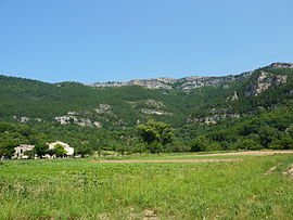
 Cirque du Bout du Monde Cirque du Bout du Monde | |
| Location of Saint-Étienne-de-Gourgas | |
  | |
| Coordinates: 43°46′14″N 3°22′42″E / 43.7706°N 3.3783°E / 43.7706; 3.3783 | |
| Country | France |
| Region | Occitania |
| Department | Hérault |
| Arrondissement | Lodève |
| Canton | Lodève |
| Intercommunality | Lodévois-Larzac |
| Government | |
| • Mayor (2020–2026) | Jean-Luc Requi |
| Area | 19.43 km (7.50 sq mi) |
| Population | 520 |
| • Density | 27/km (69/sq mi) |
| Time zone | UTC+01:00 (CET) |
| • Summer (DST) | UTC+02:00 (CEST) |
| INSEE/Postal code | 34251 /34700 |
| Elevation | 240–762 m (787–2,500 ft) (avg. 380 m or 1,250 ft) |
| French Land Register data, which excludes lakes, ponds, glaciers > 1 km (0.386 sq mi or 247 acres) and river estuaries. | |
| This article includes a list of references, related reading, or external links, but its sources remain unclear because it lacks inline citations. Please help improve this article by introducing more precise citations. (August 2023) (Learn how and when to remove this message) |
Saint-Étienne-de-Gourgas (Languedocien: Sant Estève de Gorgàs) is a commune in the Hérault department in the Occitanie region in southern France.
Geography
Saint-Étienne-de-Gourgas is known for the "Cirque du Bout du Monde" which was formed from a meander in the Ruisseau de la Bronzinadouïre that cut deeply into the plateau of the Causse du Larzac leaving the monumental chalk cliffs.
Population
| Year | Pop. | ±% |
|---|---|---|
| 1962 | 221 | — |
| 1968 | 233 | +5.4% |
| 1975 | 212 | −9.0% |
| 1982 | 254 | +19.8% |
| 1990 | 253 | −0.4% |
| 1999 | 308 | +21.7% |
| 2008 | 449 | +45.8% |
See also
References
- "Répertoire national des élus: les maires". data.gouv.fr, Plateforme ouverte des données publiques françaises (in French). 9 August 2021.
- "Populations de référence 2022" (in French). The National Institute of Statistics and Economic Studies. 19 December 2024.
This Hérault geographical article is a stub. You can help Misplaced Pages by expanding it. |