| Citadel Mountain | |
|---|---|
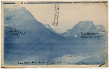
 Citadel Mountain in center with Dusty Star Mountain at left and Mount Jackson at right Citadel Mountain in center with Dusty Star Mountain at left and Mount Jackson at right | |
| Highest point | |
| Elevation | 9,035 ft (2,754 m) NAVD 88 |
| Prominence | 2,150 ft (660 m) |
| Parent peak | Little Chief Mountain |
| Coordinates | 48°37′56″N 113°39′18″W / 48.6321945°N 113.6551103°W / 48.6321945; -113.6551103 |
| Geography | |
  | |
| Location | Glacier County, Montana, U.S. |
| Parent range | Lewis Range |
| Topo map | USGS Logan Pass |
| Climbing | |
| First ascent | 1939 by Dyson, Iverson and Lindsey |
| Easiest route | Strenuous hike, class 2 |
Citadel Mountain (9,035 feet or 2,754 meters) is located in the Lewis Range, Glacier National Park in the U.S. state of Montana. The mountain is located at the western edge of Saint Mary Lake and is easily seen from the Going-to-the-Sun Road.

See also
References
- ^ "Citadel Mountain, Montana". Peakbagger.com. Retrieved March 7, 2010.
- "Citadel Mountain". Geographic Names Information System. United States Geological Survey, United States Department of the Interior. Retrieved September 26, 2010.
- "Citadel Mountain". SummitPost.org. Retrieved March 22, 2014.
- Logan Pass, MT (Map). TopoQwest (United States Geological Survey Maps). Retrieved June 7, 2018.
This Glacier County, Montana state location article is a stub. You can help Misplaced Pages by expanding it. |