| Coronel Portillo | |
|---|---|
| Province | |
 Coat of arms Coat of arms | |
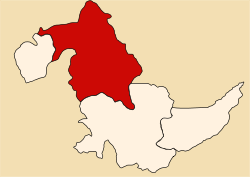
 Location of Coronel Portillo in the Ucayali Region Location of Coronel Portillo in the Ucayali Region | |
| Country | Peru |
| Region | Ucayali |
| Capital | Pucallpa |
| Government | |
| • Mayor | Segundo Leónidas Pérez Collazos (2019-2022) |
| Area | |
| • Total | 36,235.95 km (13,990.78 sq mi) |
| Population | |
| • Total | 384,168 |
| • Density | 11/km (27/sq mi) |
| UBIGEO | 2501 |
| Website | www.mpcp.gob.pe |
Coronel Portillo is the second largest of four provinces in the Ucayali Region in Peru. Its capital is Pucallpa.
Languages
According to the 2007 census, 92.8% of the population spoke Spanish as their first language, while 0.8% spoke Quechua, 0.5% spoke Asháninka, 0.1% spoke Aymara and 5.7% spoke other indigenous languages.
Political division
The province is divided into seven districts (Spanish: distritos, singular: distrito), each of which is headed by a mayor (alcalde). The districts, with their capitals in parentheses, are:
- Callería (Pucallpa)
- Campoverde (Campoverde)
- Iparía (Iparia)
- Manantay (San Fernando)
- Masisea (Masisea)
- Yarinacocha (Puerto Callao)
- Nueva Requena (Nueva Requena)
Places of interest
| |
|---|---|
| Atalaya | |
| Coronel Portillo | |
| Padre Abad | |
| Purús | |
8°23′00″S 74°33′00″W / 8.3833°S 74.5500°W / -8.3833; -74.5500
This Ucayali Region geography article is a stub. You can help Misplaced Pages by expanding it. |