| Cuôr Knia | |
|---|---|
| Commune | |
 | |
| Coordinates: 12°47′15″N 107°58′33″E / 12.78750°N 107.97583°E / 12.78750; 107.97583 | |
| Country | |
| Region | Central Highlands |
| Province | Đắk Lắk |
| District | Buôn Đôn |
| Area | |
| • Total | 77.28 km (29.84 sq mi) |
| Population | |
| • Total | 16,215 |
| Time zone | UTC+07:00 (Indochina Time) |
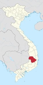
Cuôr Knia is a rural commune (xã) in the Buôn Đôn District of Đắk Lắk Province, Vietnam, not far from the Cambodia border. The commune covers an area of 77.28 square kilometres and as of 2001 had a population of 16,215 people.
Name
Its name Cây Kơ Nia from Cuôr K'nia, what means "the wild almond tree" in Rhade language.
References
- Vietnam. Tổng cục thống kê (2004). Danh mục các đơn vị hành chính Việt Nam, 2004: ban hành theo QĐ số 124/2004/QĐ-TTg ngày 8/7/2004 của Thủ tướng Chính phủ. Nhà xuất bản Thống kê. p. 189. Retrieved 20 July 2012.
This article about a location in Đắk Lắk Province, Vietnam is a stub. You can help Misplaced Pages by expanding it. |
