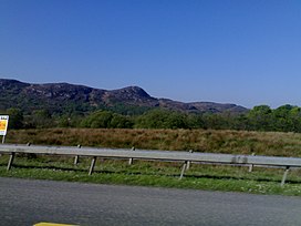
| Curlew Mountains | |
|---|---|
 The Curlew Pass The Curlew Pass | |
| Highest point | |
| Elevation | 259 m (850 ft) |
| Prominence | 197 m (646 ft) |
| Geography | |
| Location | Counties Roscommon & Sligo, Ireland |
| Parent range | Curlew Mountains |
The Curlew Mountains (Irish: An Corrshliabh, meaning 'the rough or rugged mountain') are a range of low-lying hills situated between Boyle and Castlebaldwin in northeastern Connacht.
Toponymy
The assignation of the name Curlew to the mountains may not relate the Curlew bird, but rather to the Irish: corrshliabh which means "steep-sided pointed mountains".
Geography
Geologically, the Curlew Mountains are made of Devonian sandstone and conglomerate that is harder than the surrounding Carboniferous limestone, hence their appearance as an upland feature.
History
The Battle of Curlew Pass, in which Irish forces led by Red Hugh O'Donnell defeated an English army of about 2000 was fought here on 15 August 1599.
References
- Cotton (2017a).
- Mac Coitir (2017), "Birds in Irish Place Names".
- Cotton (2017b).
- D'Alton (1845), pp. 221–226.
- Cotton, D (2017a). "Curlew Mountains". IT Sligo. Archived from the original on 8 October 2017. Retrieved 8 October 2017.
- Cotton, D (2017b). "Curlew Mountains (419 to 359 Ma)". IT Sligo. Archived from the original on 8 October 2017. Retrieved 8 October 2017.
- D'Alton, John (1845). The history of Ireland, from the earliest period to the year 1245, when the Annals of Boyle, which are adopted and embodied as the running text authority, terminate: With a brief essay on the native annalists, and other sources for illustrating Ireland, and full statistical and historical notices of the barony of Boyle. Dublin: author.
- Mac Coitir, Niall (27 February 2017). Ireland's Birds: Myths, Legends & Folklore. The Collins Press. ISBN 978-1848892989. OCLC 1078888226.
54°01′0″N 8°18′0″W / 54.01667°N 8.30000°W / 54.01667; -8.30000
| Mountains and hills of Connacht | |||||||
|---|---|---|---|---|---|---|---|
| List of mountains in Ireland | |||||||
| Achill Island |  | ||||||
| Dartry Mountains | |||||||
| Maumturks | |||||||
| Mweelrea Mountains | |||||||
| Nephin Range | |||||||
| Ox Mountains | |||||||
| Partry Mountains | |||||||
| Sheeffry Range | |||||||
| Benna Beola |
| ||||||
| Others | |||||||