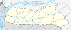
| This article needs additional citations for verification. Please help improve this article by adding citations to reliable sources. Unsourced material may be challenged and removed. Find sources: "Dalu, Meghalaya" – news · newspapers · books · scholar · JSTOR (August 2018) (Learn how and when to remove this message) |
Town in Meghalaya, India
| Dalu | |
|---|---|
| town | |
  | |
| Coordinates: 25°13′50″N 90°12′40″E / 25.23056°N 90.21111°E / 25.23056; 90.21111 | |
| Country | |
| State | Meghalaya |
| District | West Garo Hills |
| Government | |
| • Type | Democracy |
| • Body | Congress |
| Elevation | 16 m (52 ft) |
| Languages | |
| • Official | English |
| Time zone | UTC+5:30 (IST) |
| Vehicle registration | ML |
| Coastline | 0 kilometres (0 mi) |
| Climate | Am |
Dalu is a village in West Garo Hills district, Meghalaya, India famous for coal export in North East India.
Location

National Highway 51 and National Highway 62 ends at Dalu. Nearest airport is Baljek Airport Baljek, 33 km (21 mi) North-east of Tura in Meghalaya, India.
References
- "Report of the Commissioner for linguistic minorities: 47th report (July 2008 to June 2010)" (PDF). Commissioner for Linguistic Minorities, Ministry of Minority Affairs, Government of India. pp. 84–89. Archived from the original (PDF) on 13 May 2012. Retrieved 4 June 2023.
External links
This article related to a location in the Indian state of Meghalaya is a stub. You can help Misplaced Pages by expanding it. |