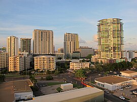
This article is about the area with the postcode 0800 in the Northern Territory known as Darwin. For the city and metropolitan area, also known as Darwin, see Darwin, Northern Territory. Suburb of Darwin, the Northern Territory, Australia
| Darwin CBD Darwin, Northern Territory | |||||||||||||||
|---|---|---|---|---|---|---|---|---|---|---|---|---|---|---|---|
 Darwin CBD Darwin CBD | |||||||||||||||
 | |||||||||||||||
| Coordinates | 12°27′39″S 130°50′40″E / 12.460834°S 130.844442°E / -12.460834; 130.844442 | ||||||||||||||
| Population | 6,464 (2016 census) | ||||||||||||||
| Established | 1869 | ||||||||||||||
| Postcode(s) | 0800 | ||||||||||||||
| LGA(s) | |||||||||||||||
| Territory electorate(s) | Port Darwin | ||||||||||||||
| Federal division(s) | Solomon | ||||||||||||||
| |||||||||||||||
| Footnotes | Adjoining suburbs | ||||||||||||||
Darwin City (also referred to as Darwin city centre or The CBD) is a suburb in metropolitan Darwin which comprises the original settlement, the central business district, parkland and other built-up areas. It is the traditional country and waterways of the Larrakia people. It is original site of occupation and includes many of the city's important institutions and landmarks, such as Parliament, Government House, the Northern Territory Supreme Court, Bicentennial Park and the George Brown Darwin Botanic Gardens. The city centre is located in the local government areas of the City of Darwin and the Darwin Waterfront Precinct.
Although the city centre is one of the most developed areas of Darwin, demographically it is one of the less densely populated, due to its core being commercial.
History
Further information: History of DarwinThe Larrakia people are the traditional owners of the lands and waters in and surrounding the Darwin local government area. Darwin is known as Garramilla in Gulumirrgin, one of the languages of the Larrakia people, but there are many place names within the area.
The first British person to see Darwin harbour appears to have been Lieutenant John Lort Stokes of HMS Beagle on 9 September 1839. The ship's captain, Commander John Clements Wickham, named the port after Charles Darwin, the British naturalist who had sailed with them both on the earlier second expedition of the Beagle.
In the early 1870s, Darwin felt the effects of a gold rush at Pine Creek after employees of the Australian Overland Telegraph Line found gold while digging holes for telegraph poles.
On 5 February 1869, George Goyder, the Surveyor General of South Australia, established a small settlement of 135 people at Port Darwin. Goyder named the settlement Palmerston, after the British Prime Minister Lord Palmerston. In 1870, the first poles for the Overland Telegraph were erected in Darwin, connecting Australia to the rest of the world. The discovery of gold at Pine Creek in the 1880s further boosted the young territory's development. Upon Commonwealth administration in 1911, Darwin became the city's official name.
Geography
The city centre is bordered by Daly Street to the north and extends east to the Stuart Highway McMinn Street to the east which borders Stuart Park. The border extends and east along Darwin Harbour it extends South the Darwin Waterfront and to the Darwin Convention Centre. It extends West along the Esplande and Bicentennial Park.
Demographics
According to the 2016 census of Population, there were 6,464 people in Darwin City.
- Aboriginal and Torres Strait Islander people made up 3.4% of the population.
- 41.7% of people were born in Australia. The next most common countries of birth were England 4.7%, Philippines 3.3%, Japan 3.3%, India 2.9% and Taiwan 2.8%.
- 53.6% of people spoke only English at home. Other languages spoken at home included Mandarin 5.0%, Japanese 3.3%, Nepali 2.2%, Tagalog 1.8% and Korean 1.6%.
- The most common response for religion was No Religion at 34.9%.
References
- "Place Names Register Extract for "Darwin City"". NT Place Names Register. Northern Territory Government. Retrieved 16 March 2019.
- ^ Australian Bureau of Statistics (27 June 2017). "Darwin City (State Suburb)". 2016 Census QuickStats. Retrieved 28 June 2017.

- ^ "Annual Report 2006/2007" (PDF). Darwin Waterfront Corporation. 15 October 2007. p. 3. Retrieved 7 June 2019.
- "Darwin City Council Suburbs" (PDF). Place Names Committee. Northern Territory Government. Archived from the original (PDF) on 18 March 2019. Retrieved 16 March 2019.
- "Localities within (East Arm) Un-Incorporated area" (PDF). Place Names Committee. Northern Territory Government. Retrieved 16 March 2019.
- "The Larrakia People". Larrakia Nation. 31 March 2023. Retrieved 1 December 2023.
- "The Larrakia People". Larrakia Nation. 31 March 2023. Retrieved 21 December 2023.
- "Home | Larrakia Development Corporation". www.larrakia.com.au. 9 February 2014. Retrieved 1 December 2023.
- "City of Darwin streets and roads". Archived from the original on 24 May 2008. Retrieved 15 June 2008.
| Suburbs of the City of Darwin by ward, Darwin, Northern Territory | |
|---|---|
| Chan Ward | |
| Lyons Ward |
|
| Richardson Ward | |
| Waters Ward |
|
| Capital city central business districts of Australia | ||||||||||
|---|---|---|---|---|---|---|---|---|---|---|


