Unincorporated community in Montana, United States
| Dean, Montana | |
|---|---|
| unincorporated community | |
  | |
| Coordinates: 45°24′17″N 109°41′26″W / 45.40472°N 109.69056°W / 45.40472; -109.69056 | |
| Country | United States |
| State | Montana |
| County | Stillwater |
| Elevation | 5,236 ft (1,596 m) |
| Time zone | UTC-7 (Mountain (MST)) |
| • Summer (DST) | UTC-6 (MDT) |
| ZIP code | 59061 |
| Area code | 406 |
| GNIS feature ID | 782167 |
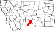
Dean is an unincorporated community located in Stillwater County, Montana, United States.
Dean is at an elevation of 5,244 feet and appears on the Beehive U.S. Geological Survey Map, while sharing a ZIP code with Nye of 59061.
History
Located on the north side of the Beartooth Mountains, Dean has its roots mainly in agriculture and a few nearby mines. Dean's post office was established on Mar 10, 1902 with Bessie Haskin as its first postmaster. The post office was closed on April 15, 1914, and then reopened from 1915 to 1951.
Today, Dean survives as a small community with a number of permanent and seasonal homes.
References
- ^ U.S. Geological Survey Geographic Names Information System: Dean, Montana
- "US Gazetteer files: 2010, 2000, and 1990". United States Census Bureau. February 12, 2011. Retrieved April 23, 2011.
- "U.S. Census website". United States Census Bureau. Retrieved May 14, 2011.
- Lutz, Dennis J (1986). Montana Post Offices & Postmasters.
| Municipalities and communities of Stillwater County, Montana, United States | ||
|---|---|---|
| County seat: Columbus | ||
| Town |  | |
| CDPs | ||
| Other communities | ||
| Ghost towns | ||
This Stillwater County, Montana state location article is a stub. You can help Misplaced Pages by expanding it. |