| Delaware County Regional Airport | |||||||||||||||
|---|---|---|---|---|---|---|---|---|---|---|---|---|---|---|---|
| Summary | |||||||||||||||
| Airport type | Public | ||||||||||||||
| Owner | Delaware County Airport Authority | ||||||||||||||
| Serves | Muncie, Indiana | ||||||||||||||
| Elevation AMSL | 937 ft / 286 m | ||||||||||||||
| Coordinates | 40°14′33″N 085°23′45″W / 40.24250°N 85.39583°W / 40.24250; -85.39583 | ||||||||||||||
| Map | |||||||||||||||
  | |||||||||||||||
| Runways | |||||||||||||||
| |||||||||||||||
| Statistics (2010) | |||||||||||||||
| |||||||||||||||
| Source: Federal Aviation Administration | |||||||||||||||
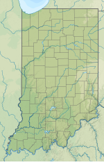
Delaware County Regional Airport (IATA: MIE, ICAO: KMIE, FAA LID: MIE) is in Delaware County, Indiana three miles northwest of Muncie. Owned by the Delaware County Airport Authority, it was formerly Delaware County Airport and Johnson Field. The National Plan of Integrated Airport Systems for 2011–2015 categorized it as a general aviation facility.
Facilities
The airport covers 963 acres (390 ha) at an elevation of 937 feet (286 m). It has two asphalt runways: 14/32 is 6,500 by 150 feet (1,981 x 46 m) and 3/21 is 5,198 by 100 feet (1,584 x 30 m).
In 2010 the airport had 23,644 aircraft operations, average 64 per day: 95% general aviation, 3% military, 2% air taxi, and 0% airline. It was home base to 22 aircraft: 86.5% single-engine, 4.5% multi-engine, 4.5% jet, and 4.5% helicopter.
Scheduled airlines
Airline flights started in 1958—Lake Central DC-3s. In 1981 Allegheny Commuter flew to Chicago-O'Hare and Indianapolis. By 1985 flights to Chicago were on Britt Airways and Indianapolis flights had ended. Great Lakes Airlines operated flights to and from Chicago's O'Hare International Airport in the 1990s.
Businesses
- Muncie Aviation Company, the fixed-base operator (FBO).
See also
References
- ^ FAA Airport Form 5010 for MIE PDF. Federal Aviation Administration. Effective November 15, 2012.
- "Delaware County Regional Airport" (PDF). Small Community Air Service Development Program. August 2010.
- "IATA Airport Code Search (MIE: Delaware County)". International Air Transport Association. Retrieved August 8, 2013.
- "KMIE – Delaware County Airport (Johnson Field)". FAA data republished by AirNav. February 11, 2010. Archived from the original on April 7, 2010.
- Airlines and Aircraft Serving Chicago O'Hare Effective April 1, 1981, Departed Flights, Retrieved 2014-08-29
- Airlines and Aircraft Serving Indianapolis Effective April 1, 1981, Departed Flights, Retrieved 2014-08-29
- Airlines and Aircraft Serving Chicago O'Hare Effective February 15, 1985, Departed Flights, Retrieved 2014-08-29
- "Muncie Aviation Company". Official site. Archived from the original on September 8, 2013. Retrieved August 8, 2013.
External links
- Official website
- Aerial photo from Indiana DOT at the Wayback Machine (archived August 15, 2010)
- Aerial image as of April 1998 from USGS The National Map
- FAA Airport Diagram for MIE (PDF), effective December 26, 2024
- FAA Terminal Procedures for MIE, effective December 26, 2024
- Resources for this airport:
- FAA airport information for MIE
- AirNav airport information for KMIE
- ASN accident history for MIE
- FlightAware airport information and live flight tracker
- NOAA/NWS weather observations: current, past three days
- SkyVector aeronautical chart, Terminal Procedures