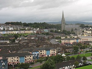
54°59′38″N 7°19′34″W / 54.994°N 7.326°W / 54.994; -7.326 The Derry Urban Area is the urban area that includes and surrounds the city of Derry in Northern Ireland, and is part of the Derry City and Strabane District Council area. It had a population of 93,512 in the 2001 census. It is the second-largest urban area in Northern Ireland (after Belfast) and the fifth-largest urban area in Ireland (after Dublin, Belfast, Cork and Limerick).
The Derry Urban Area consists of Derry City, Culmore, New Buildings and Strathfoyle.
The Greater Derry area, the area within about 20 mi (32.2 km) of the city, has a population of 237,000 and comprises Derry City Council, Limavady Borough Council, Strabane District council excluding the Castlederg area, and parts of North East Donegal in the Republic of Ireland, namely Inishowen, Letterkenny, Ballybofey/Stranorlar and Lifford. The term, like the term Greater Belfast, has no official relevance particularly in this case, since it incorporates areas from two jurisdictions; however, it is used for ease of reference.
References
- "Archived copy" (PDF). Archived from the original (PDF) on 1 April 2014. Retrieved 13 May 2012.
{{cite web}}: CS1 maint: archived copy as title (link) - "Mapping frontiers, plotting pathways: routes to North-South cooperation in a divided island" (PDF). Queen's University Belfast. Archived from the original (PDF) on 3 March 2009. Retrieved 2 March 2020.
- Greater Derry Interactive Map Archived 2011-06-14 at the Wayback Machine. Discovernorthernireland.com (2013-05-15). Retrieved on 2013-07-23.
External links
This article related to the geography of County Londonderry, Northern Ireland is a stub. You can help Misplaced Pages by expanding it. |