| Des Plaines crater | |
|---|---|
 Information about the Des Plaines Disturbance is included in this trail marker in the Cook County Forest Preserve. The sign is near Big Bend Lake, along the Des Plaines River Trail. Information about the Des Plaines Disturbance is included in this trail marker in the Cook County Forest Preserve. The sign is near Big Bend Lake, along the Des Plaines River Trail. | |
| Impact crater/structure | |
| Diameter | 8 kilometres (5.0 mi) |
| Age | <280 Ma |
| Exposed | No |
| Drilled | Yes |
| Location | |
| Country | USA |
| State | Illinois |
| Municipality | Des Plaines |
  | |
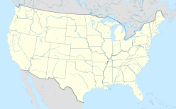
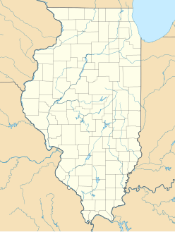
The Des Plaines crater or Des Plaines disturbance is recognized as an impact crater in Cook County, Illinois, United States. It is located beneath the eastern part of the city of Des Plaines, which is a suburb of Chicago.
The Des Plaines crater is 5.5 miles (8.9 km) in diameter and covers an area of approximately 25 square miles (65 km). The age of the crater is unknown but is thought to be between 280 million years and 2 million years (Permian or younger). The crater is buried beneath 75 to 200 feet (23–60 m) of glacial till and can only be seen as a series of faults and deformations in well logs and seismic surveys. Faulting in the structure has produced as much as 600 feet (180 m) of vertical displacement. Subsurface strata of Cambrian through Pennsylvanian age has been faulted and tilted by the event. The anomalous area was first noted by water well drillers in 1893, who noted an absence of water in a 1,600-foot (490 m) deep well. Prior to being recognized as an impact structure, the feature was referred to as a cryptoexplosion structure or cryptovolcanic structure, as were several others in the Midwestern United States. The upfaulted central portion and the presence of shatter cone structures support the impact origin.
References
- ^ Wiggers, Ray (1997). Geology Underfoot in Illinois. Missoula, Mont: Mountain Press Pub. Co. pp. 74, 82–83. ISBN 978-0-87842-346-0.
- "Des Plaines". Earth Impact Database. University of New Brunswick. Archived from the original on 29 November 2014. Retrieved 21 November 2014.
- ^ "Faulting and the Des Plaines Disturbance". Prairie Research Institute. 23 October 2009. Archived from the original on 7 April 2014. Retrieved 21 November 2014.
- Bentle, Kyle (February 7, 2017). "When a Meteor Hit: Millions of Years Ago in Des Plaines". Chicago Tribune. Retrieved January 5, 2018.
When did it happen? Scientists don't know, exactly, but you can narrow it down to a 300-million year timeframe, Monson said. The oldest the impact could be dates back to the Pennsylvanian Period in the geologic time scale, 299 million to 323 millions years ago. The youngest it could be is about 2 million years, when advancing glaciers covered the crater.
- ^ Emrich, Grover H.; Bergstrom, Robert E. (12 July 1960). "Des Plaines Disturbance, Northeastern Illinois". GSA Bulletin. 73 (8): 959–968. doi:10.1130/0016-7606(1962)73[959:DPDNI]2.0.CO;2. Retrieved 21 November 2014.
External links
| Des Plaines, Illinois | |
|---|---|
| Public schools | |
| Private schools | |
| Other education | |
| Landmarks | |
| Transportation | |
| This list is incomplete. | |
42°3′N 87°52′W / 42.050°N 87.867°W / 42.050; -87.867
This Cook County, Illinois location article is a stub. You can help Misplaced Pages by expanding it. |

