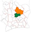
Place in Vallée du Bandama, Ivory Coast
| Diabo | |
|---|---|
| Town, sub-prefecture, and commune | |
 | |
| Coordinates: 7°47′N 5°11′W / 7.783°N 5.183°W / 7.783; -5.183 | |
| Country | |
| District | Vallée du Bandama |
| Region | Gbêkê |
| Department | Botro |
| Population | |
| • Total | 26,272 |
| Time zone | UTC+0 (GMT) |
Diabo is a town in central Ivory Coast. It is a sub-prefecture and commune of Botro Department in Gbêkê Region, Vallée du Bandama District.
In 2014, the population of the sub-prefecture of Diabo was 26,272.
Villages
The 27 villages of the sub-prefecture of Diabo and their population in 2014 are:
- Adjékro (1 613)
- Agbakro (1 386)
- Akokokro (228)
- Diabo (8 522)
- Djaha Andokro (227)
- Groh (511)
- Kitipo (165)
- Kokokro (171)
- Konan Kpinkro (224)
- Kondoubo (810)
- Kouassi Golikro (550)
- Langbo (332)
- Messoukro (322)
- Adjonou (200)
- Assekro (426)
- Konanblékro (664)
- Langama (1 016)
- N'gatta Koffikro (1 238)
- N'gattakro (348)
- N'guessan Kouamékro (201)
- Sélakro (517)
- Sinzékro (1 052)
- Soussoubo (413)
- Télébokan (1 038)
- Télébokpli (1 257)
- Tikakro (1 401)
- Yomien-Kouadiokro (1 440)
Notes
- "Côte d'Ivoire". geohive.com. Retrieved 14 December 2015.
- ^ "RGPH 2014, Répertoire des localités, Région Gbêkê" (PDF). ins.ci. Retrieved 5 August 2019.
| Regional seat: Bouaké | ||
| Béoumi Department |  | |
| Botro Department | ||
| Bouaké Department | ||
| Sakassou Department | ||
| * also a commune | ||
This Vallée du Bandama District location article is a stub. You can help Misplaced Pages by expanding it. |