(Redirected from Divisions of Gujarat )
Districts of Gujarat
See also: Cities of Gujarat , Talukas of Gujarat , and Metropolitan areas of Gujarat
Districts of Gujarat Category Districts Location Gujarat Number 34 districts Populations Dang – 228,291 (lowest); Ahmedabad – 7,214,225 (highest)Areas Dang – 1,764 km (681 sq mi) (smallest); Kutch – 45,674 km (17,635 sq mi) (largest)Government Subdivisions
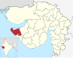
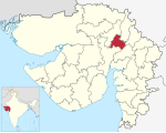
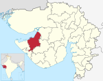
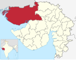
The western Indian state of Gujarat has 34 districts after several splits of the original 17 districts at the formation of the state in 1960. Kutch is the largest district of Gujarat while Dang is the smallest. Ahmedabad is the most populated district while Dang is the least. There are 252 Talukas (subdivisions of districts) in Gujarat.
History
1960
Gujarat state was created on 1 May 1960, out of the 17 northern districts of Bombay State when that was split on a linguistic basis (also creating Marathi speaking Maharashtra ).
They are as follow : Ahmedabad , Amreli , Banaskantha , Bharuch , Bhavnagar , Dang , Jamnagar , Junagadh , Kheda , Kachchh , Mehsana , Panchmahal , Rajkot , Sabarkantha , Surat , Surendranagar and Vadodara .
1964
In 1964, Gandhinagar was formed from parts of Ahmedabad and Mehsana .
1966
In 1966, Valsad was split from Surat .
1997
On 2 October 1997, five new districts were created:
2000
In 2000, Patan District was formed from parts of Banaskantha and Mehsana .
2007
On 2 October 2007, Tapi was split from Surat , as the state's 26th district.
2013
On 15 August 2013, seven new districts were created:
2025
In 2025, Vav-Tharad Banaskantha
The newly formed Vav-Tharad district will include a total of 8 talukas namely Vav, Bhabhar, Tharad, Dhanera, Suigam, Lakhni, Deodar and Kankrej and four municipalities namely Bhabhar, Tharad, Thara and Dhanera. The remaining 6 talukas of Banaskantha district will include a total of 6 talukas namely Palanpur, Danta, Amirgarh, Dantiwada, Vadgam and Deesa and two municipalities namely Palanpur and Deesa. (Source: Gujarati Jagran )
List of districts
Main article: Demographics of districts of Gujarat
S.No.
District
Headquarters
Year of Formation
Area (km)
Population
Population
density (/km)
2011
Taluks
Total Villages
Map
2001 Census
2011 Census
1
Ahmedabad
Ahmedabad City
8087
5,673,090
7,045,313
890
558
2
Amreli
Amreli
1,393,880
1,513,614
598
3
Anand
Anand
1,856,712
2,090,276
365
4
Aravalli
Modasa
908,797
1,039,918
682
5
Banaskantha
Palanpur
4,486
2,502,843
3,116,045
1250
6
Bharuch
Bharuch
1,370,104
1,550,822
647
7
Bhavnagar
Bhavnagar
2,065,492
2,393,272
800
8
Botad
Botad
547,567
656,005
53
9
Chhota Udaipur
Chhota Udaipur
909,799
1,071,831
894
10
Dahod
Dahod
1,635,374
2,126,558
696
11
Dang
Ahwa
186,712
226,769
311
12
Devbhoomi Dwarka
Khambhalia
623,091
752,484
249
13
Gandhinagar
Gandhinagar
1,334,731
1,387,478
302
14
Gir Somnath
Veraval
1,059,675
1,217,477
345
15
Jamnagar
Jamnagar
1,281,187
1,407,635
No.
Talukas
1
Jamnagar
2
Dhrol
3
Jamjodhpur
4
Jodiya
5
Kalavad
6
Lalpur
113
16
Junagadh
Junagadh
1,388,498
1,525,605
No.
Talukas
1
Junagadh City
2
Bhesana
3
Junagadh Rural
4
Keshod
5
Malia
6
Manavadar
7
Mangrol
8
Mendarda
9
Vanthali
10
Visavadar
547
17
Kutch
Bhuj
1,526,321
2,090,313
No.
Talukas
1
Abdasa
2
Anjar
3
Bhachau
4
Bhuj
5
Gandhidham
6
Lakhpat
7
Mandvi
8
Mundra
9
Nakhatrana
10
Rapar
1389
18
Kheda
Nadiad
1,806,929
2,053,769
No.
Talukas
1
Kheda
2
Galteshwar
3
Kapadvanj
4
Kathlal
5
Mahudha
6
Matar
7
Mehmedabad
8
Nadiad
9
Thasra
10
Vaso
620
19
Mahisagar
Lunavada
861,562
994,624
No.
Talukas
1
Balasinor
2
Kadana
3
Khanpur
4
Lunawada
5
Santrampur
6
Virpur
941
20
Mehsana
Mehsana
1,837,696
2,027,727
No.
Talukas
1
Mehsana
2
Becharaji
3
Jotana
4
Kadi
5
Kheralu
6
Satlasana
7
Unjha
8
Vadnagar
9
Vijapur
10
Visnagar
614
21
Morbi
Morbi
825,301
960,329
No.
Talukas
1
Halvad
2
Maliya
3
Morbi
4
Tankara
5
Wankaner
78
22
Narmada
Rajpipla
514,083
590,379
No.
Talukas
1
Dediapada
2
Garudeshwar
3
Nandod
4
Sagbara
5
Tilakwada
527
23
Navsari
Navsari
1,229,250
1,330,711
No.
Talukas
1
Navsari
2
Vansda
3
Chikhli
4
Gandevi
5
Jalalpore
6
Khergam
389
24
Panchmahal
Godhra
1,381,002
1,642,268
No.
Talukas
1
Ghoghamba
2
Godhra
3
Halol
4
Jambughoda
5
Kalol
6
Morwa Hadaf
7
Shehera
604
25
Patan
Patan
1,181,941
1,342,746
No.
Talukas
1
Patan
2
Chanasma
3
Harij
4
Radhanpur
5
Sami
6
Sankheswar
7
Santalpur
8
Sarasvati
9
Sidhpur
521
26
Porbandar
Porbandar
536,854
586,062
No.
Talukas
1
Porbandar
2
Kutiyana
3
Ranavav
149
27
Rajkot
Rajkot
2,488,885
3,015,229
No.
Talukas
1
Rajkot
2
Dhoraji
3
Gondal
4
Jamkandorna
5
Jasdan
6
Jetpur
7
Kotada Sangani
8
Lodhika
9
Paddhari
10
Upleta
11
Vinchchiya
856
28
Sabarkantha
Himmatnagar
1,173,734
1,388,671
No.
Talukas
1
Himatnagar
2
Idar
3
Khedbrahma
4
Poshina
5
Prantij
6
Talod
7
Vadali
8
Vijaynagar
702
29
Surat
Surat City
4,996,391
6,079,231
No.
Talukas
1
Surat
2
Bardoli
3
Choryasi
4
Kamrej
5
Mahuva
6
Mandvi
7
Mangrol
8
Olpad
9
Palsana
10
Umarpada
729
30
Surendranagar
Surendranagar
1,370,843
1,585,268
No.
Talukas
1
Chotila
2
Chuda
3
Dasada
4
Dhrangadhra
5
Lakhtar
6
Limbdi
7
Muli
8
Sayla
9
Thangadh
10
Wadhwan
654
31
Tapi
Vyara
719,634
806,489
No.
Talukas
1
Nizar
2
Songadh
3
Uchhal
4
Valod
5
Vyara
6
Kukarmunda
7
Dolvan
523
32
Vadodara
Vadodara City
2,732,003
3,093,795
No.
Talukas
1
Vadodara
2
Dabhoi
3
Desar
4
Karjan
5
Padra
6
Savli
7
Sinor
8
Waghodia
694
33
Valsad
Valsad
1,410,680
1,703,068
No.
Talukas
1
Valsad
2
Dharampur
3
Kaprada
4
Pardi
5
Umbergaon
6
Vapi
460
34
Vav-Tharad
Tharad
2025
6,257
No.
Talukas
1
Vav
2
Tharad
3
Bhabhar
4
Dhanera
5
Suigam
6
Lakhani
7
Deodar
8
Kankrej
Total
Talukas : 251
Proposed districts
See also
References
"Gujarat | District Portal" . gujarat.s3waas.gov.in . Retrieved 2 March 2023.Dave, Kapil (7 October 2012). "Next Republic Day, Gujarat will be bigger..." The Indian Express . Retrieved 13 October 2012.
"Village Map - Revenue Department" . Internet Archive . 25 March 2016. Archived from the original on 25 March 2016. Retrieved 9 April 2016."State Govt Announces 23 New Talukas" . 10 September 2013. Archived from the original on 6 February 2016. Retrieved 5 January 2016."Gujarat Govt made major announcement Dholera SIR at Dholera district" . Dholera SIR Government of India . Retrieved 6 January 2009."Ranking of Districts by Population Size, 2001 and 2011" . 2011 census of India Government of India . Retrieved 3 May 2012."Ranking of Districts by Population Size, 2001 and 2011" . 2011 census of India Government of India . Retrieved 3 May 2012."Village & Panchayats | Ahmedabad District, Government Of Gujarat | India" . Retrieved 9 February 2023."Gujarat government planning to carve out new districts before panchayat elections" , Times of India , 24 September 2024
External links
Categories :
Text is available under the Creative Commons Attribution-ShareAlike License. Additional terms may apply.
**DISCLAIMER** We are not affiliated with Wikipedia, and Cloudflare.
The information presented on this site is for general informational purposes only and does not constitute medical advice.
You should always have a personal consultation with a healthcare professional before making changes to your diet, medication, or exercise routine.
AI helps with the correspondence in our chat.
We participate in an affiliate program. If you buy something through a link, we may earn a commission 💕
↑
 Districts of Gujarat


