CDP in Ohio, United States
| Dundee, Ohio | |
|---|---|
| CDP | |
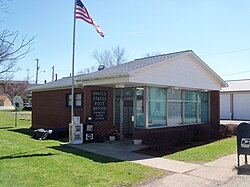
 Dundee Post Office Dundee Post Office | |
 Location of Dundee, Ohio Location of Dundee, Ohio | |
| Coordinates: 40°35′13″N 81°36′25″W / 40.58694°N 81.60694°W / 40.58694; -81.60694 | |
| Country | United States |
| State | Ohio |
| County | Tuscarawas |
| Township | Wayne |
| Elevation | 1,027 ft (313 m) |
| Population | |
| • Total | 269 |
| Time zone | UTC-5 (Eastern (EST)) |
| • Summer (DST) | UTC-4 (EDT) |
| ZIP code | 44624 |
| GNIS feature ID | 2628886 |
Dundee is a census-designated place in central Wayne Township, Tuscarawas County, Ohio, United States. It has a post office with the ZIP code 44624. It lies at the intersection of State Routes 93 and 516. The population was 269 at the 2020 census.
History
Dundee was laid out and platted in 1847. A post office called Dundee has been in operation since 1847.
References
- ^ U.S. Geological Survey Geographic Names Information System: Dundee, Ohio
- "Dundee CPD, Ohio - Census Bureau Profile". United States Census Bureau. Retrieved September 3, 2023.
- Zip Code Lookup
- The History of Tuscarawas County, Ohio: Containing a History of the County; Its Townships, Towns, Churches, Schools, Etc. Warner, Beers & Company. 1884. p. 684.
- "Tuscarawas County". Jim Forte Postal History. Archived from the original on March 4, 2016. Retrieved January 6, 2016.
| Municipalities and communities of Tuscarawas County, Ohio, United States | ||
|---|---|---|
| County seat: New Philadelphia | ||
| Cities |  | |
| Villages | ||
| Townships | ||
| CDPs | ||
| Unincorporated communities | ||
| Ghost town | ||
| Footnotes | ‡This populated place also has portions in an adjacent county or counties | |
This Tuscarawas County, Ohio state location article is a stub. You can help Misplaced Pages by expanding it. |