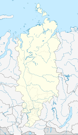
| Ekonda Эконда | |
|---|---|
| Rural settlement | |
 | |
| Location of Ekonda | |
  | |
| Coordinates: 65°46′N 105°20′E / 65.767°N 105.333°E / 65.767; 105.333 | |
| Country | Russia |
| Federal subject | Krasnoyarsk Krai |
| Administrative district | Evenkiysky District |
| Founded | 1947 |
| Area | |
| • Total | 0.43 km (0.17 sq mi) |
| Elevation | 500 m (1,600 ft) |
| Population | |
| • Total | 291 |
| • Density | 680/km (1,800/sq mi) |
| Time zone | UTC+7 (MSK+4 |
| Postal code(s) | 648592 |
| OKTMO ID | 04650453101 |
Ekonda (Russian: Эконда) is a rural locality in Evenkiysky District of Krasnoyarsk Krai, Russia, located in an area of lakes. Population: 317 (2021 Census); 291 (2010 Census); KrasAvia operates flights to Ekonda.
Geography
Ekonda is located by the left bank of the Vilyuy river, a little downstream from the confluence with the Pasporin. Tura, the administrative center of Evenkiysky District, lies roughly 200 km (120 mi) to the southwest. Lake Suringda, one of the largest in the area, lies to the south.
References
- ^ Russian Federal State Statistics Service. Всероссийская перепись населения 2020 года. Том 1 [2020 All-Russian Population Census, vol. 1] (XLS) (in Russian). Federal State Statistics Service.
- ^ Russian Federal State Statistics Service (2011). Всероссийская перепись населения 2010 года. Том 1 [2010 All-Russian Population Census, vol. 1]. Всероссийская перепись населения 2010 года (in Russian). Federal State Statistics Service.
- "Об исчислении времени". Официальный интернет-портал правовой информации (in Russian). June 3, 2011. Retrieved January 19, 2019.
- Почта России. Информационно-вычислительный центр ОАСУ РПО. (Russian Post). Поиск объектов почтовой связи (Postal Objects Search) (in Russian)
- "Q-47_48 Topographic Chart (in Russian)". Retrieved April 12, 2023.
- Google Earth
Categories: