Misplaced Pages

El Qanater El Khayreya

Article snapshot taken from Wikipedia with creative commons attribution-sharealike license. Give it a read and then ask your questions in the chat. We can research this topic together.
Place in Qalyubia, Egypt
El Qanater El Khayreya القناطر الخيرية
El Qanater El Khayreya is located in EgyptEl Qanater El KhayreyaEl Qanater El KhayreyaLocation in Egypt
Coordinates: 30°11′37″N 31°07′55″E / 30.193583°N 31.132064°E / 30.193583; 31.132064
Country Egypt
GovernorateQalyubia
Time zoneUTC+2 (EST)

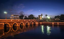
El Qanater El Khayreya (Arabic: القناطر الخيرية  pronounced [elʔɑˈnɑːtˤeɾ elxæjˈɾejjæ], "the Benevolent Bridges") is a city and a markaz in Qalyubia Governorate, Egypt. It is the location of the Delta Barrages, the first modern irrigation structure across the Nile, located at the apex of the Nile Delta. In the mid 1850s, when Viceroy Sa'id Pasha took over project construction, he ordered a silver medal to be struck to mark the occasion. He then ordered the construction of a town near the incomplete barrage. Again the project would be bogged down due to financial problems; the original barrages were initially completed in 1862. A new barrage structure was built slightly downstream in 1939. The name of the city is a reference to the structure and the river crossing it.

Geography

Climate
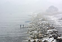
Foggy day in November 2019.

Köppen climate classification system classifies its climate as hot desert (BWh), as the rest of Egypt.

Climate data for El Qanater el Khayreyya
Month Jan Feb Mar Apr May Jun Jul Aug Sep Oct Nov Dec Year
Mean daily maximum °C (°F) 19.4
(66.9)
20.9
(69.6)
23.6
(74.5)
27.9
(82.2)
31.9
(89.4)
34.3
(93.7)
34.6
(94.3)
34.4
(93.9)
32.2
(90.0)
30
(86)
25.4
(77.7)
21
(70)
28.0
(82.4)
Daily mean °C (°F) 13
(55)
13.9
(57.0)
16.5
(61.7)
19.9
(67.8)
23.8
(74.8)
26.4
(79.5)
27.5
(81.5)
27.4
(81.3)
25.2
(77.4)
23.1
(73.6)
19.1
(66.4)
14.8
(58.6)
20.9
(69.6)
Mean daily minimum °C (°F) 6.6
(43.9)
7
(45)
9.4
(48.9)
12
(54)
15.7
(60.3)
18.5
(65.3)
20.5
(68.9)
20.4
(68.7)
18.3
(64.9)
16.2
(61.2)
12.9
(55.2)
8.6
(47.5)
13.8
(57.0)
Average precipitation mm (inches) 4
(0.2)
5
(0.2)
3
(0.1)
1
(0.0)
1
(0.0)
0
(0)
0
(0)
0
(0)
0
(0)
1
(0.0)
2
(0.1)
5
(0.2)
22
(0.8)
Source: Climate-Data.org (altitude: 18m)

References

  1. Samir Raafat, The Delta Barrage, Cairo Times, August 21, 1997
  2. "El Qanater El Khayreya (Gardens & Parks)". sis.gov.eg. 27 August 2017.
  3. ^ "Climate: Al Qanatir al Khairiya - Climate graph, Temperature graph, Climate table". Climate-Data.org. Retrieved 2014-01-03.
Cities and towns in Egypt
Cairo GovernorateCairo
Giza GovernorateGiza, 6th of October City, Sheikh Zayed City, El Hawamdeya, El Badrashein, El Saff, Atfih, El Ayyat, Bawiti, Manshiyat al Qanater, Awsim, Kerdasa, Abu El Numrus
Qalyubia GovernorateBenha, Qalyub, Shubra El Kheima, El Qanater El Khayreya, Khanka, Kafr Shukr, Toukh, Qaha, Obour City, Khusus, Shibin El Qanater, Saryaqos, El Kulzom
Alexandria GovernorateAlexandria, Borg El Arab, New Borg El Arab
Beheira GovernorateDamanhur, Kafr El Dawwar, Rosetta, Edku, Abu El Matamir, Abu Hummus, El Delengat, El Mahmoudiyah, El Rahmaniya, Itay El Barud, Hosh Issa, Shubra Khit, Koum Hamada, Badr, Wadi El Natrun, New Nubariya
Matrouh GovernorateMersa Matruh, El Hamam, El Alamein, El Dabaa, El Negaila, Sidi Barrani, Sallum, Siwa Oasis
Damietta GovernorateDamietta, New Damietta, Ras El Bar, Faraskur, Kafr Saad, El Zarqa, Assarw, Arrawda, Kafr El Battikh, Ezbet El Borg, Mit Abu Ghaleb
Dakahlia GovernorateMansoura, Talkha, Mit Ghamr, Dekernes, Aga, Minyat An-Nasr, El Senbellawein, El Kurdi, Bani Ebaid, El Manzala, Temay El Amdeed, El Gammalia, Sherbin, El Matareya, Dakahlia, Belqas, Mit Salsil, Gamasa, Mahallat Damana, Nabaruh
Kafr El Sheikh GovernorateKafr El Sheikh, Desouk, Fuwwah, Metoubes, Baltim, El Hamool, Biyala, El Reyad, Sidi Salem, Qallin, Sidi Ghazi, Borg El Burulus
Gharbia GovernorateTanta, El Mahalla El Kubra, Kafr Az-Zayyat, Zefta, El Santa, Qutur, Basyoun, Sebennytos
Monufia GovernorateShibin El Kom, Sadat (city), Menouf, Sirs Al-Layyan, Ashmoun, El Bagour, Quesna, Birket El Sab, Tala, Shuhada
Sharqia GovernorateZagazig, 10th of Ramadan (city), Minya El Qamh, Bilbeis, Mashtool El Souk, Al-Qinayat, Abu Hammad, El Qurein, Hihya, Abu Kebir, Faqous, El Salheya El Gedida, El Ibrahimiya, Diyarb Negm, Kafr Saqr, Awlad Saqr, El Husseiniya, Tanis, Minshat Abu Omar, Qantir
Port Said GovernoratePort Said, Port Fuad
Ismailia GovernorateIsmailia, Fayed, El Qantara, Tell El Kebir, Abu Suwir, Kassassin
Suez GovernorateSuez
North Sinai GovernorateArish, Sheikh Zuweid, Rafah, Bir al-Abd, El Hasana, Nekhel
South Sinai GovernorateEl Tor, Sharm El Sheikh, Dahab, Nuweiba, Taba, Saint Catherine, Abou Redis, Abu Zenima, Ras Sedr
Beni Suef GovernorateBeni Suef, New Beni Suef, Al Wasta, Nasser, Heracleopolis Magna, Biba, Sumusta, El Fashn
Faiyum GovernorateFaiyum, New Faiyum, Tamiya, Sinnuris, Itsa, Ibsheway, Yousef El Seddik
Minya GovernorateMinya, New Minya, El Idwa, Maghagha, Beni Mazar, Matai, Samalut, Mallawi, Dir Mawas, Aba al-Waqf, Dir Mawas, Dalga, Bahnasa, Idmo, Tuna el-Gebel, Al Madinah Al Fikriyyah
Asyut GovernorateAsyut, New Asyut, Dairut, Dayrut al-Sharif, Manfalut, El Quseyya, Abnub, Abu Tig, El Ghanayem, Sahel Selim, El Badari, Sidfa, Manqabad, Musha
New Valley GovernorateEl Kharga, Baris, Mut, Farafra, Balat, Abu Minqar
Red Sea GovernorateHurghada, Ras Ghareb, Safaga, El Qoseir, Marsa Alam, Shalateen, Halayeb
Sohag GovernorateSohag, New Sohag, Akhmim, New Akhmim, El Balyana, El Maragha, Ptolemais Hermiou, Dar El Salam, Girga, West Juhayna, Saqultah, Tima, Tahta
Qena GovernorateQena, New Qena, Abu Tesht, Nag Hammadi, Dishna, El Waqf, Qift, Naqada, Qus, Farshut, Shaarani
Luxor GovernorateLuxor, New Luxor, New Thebes, Zainiya, Bayadiya, Kurna, Armant, El-Tod, Esna, Medamud
Aswan GovernorateAswan, New Aswan, Daraw, Kom Ombo, Nasr Al-Nuba, Kalabsha, Edfu, Radisia, Busylia, Sebaiya, Abu Simbel
Capital cities are in bold font.


Stub icon

This geography of Egypt article is a stub. You can help Misplaced Pages by expanding it.

Categories: